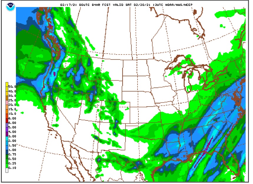
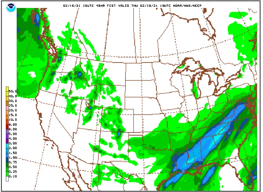
The models continue to advertise more snow starting Wednesday afternoon and continuing through Wednesday night. The latest NAM and GFS give us between 0.25 and 0.50 inches of liquid equivalent. A 20:1 inch snow ratio would result in 5 to 10 inches of new snow. A 15:1 inch ratio would result in 4 to 8 inches. Here are the latest precipitation forecasts from the NAM and GFS:
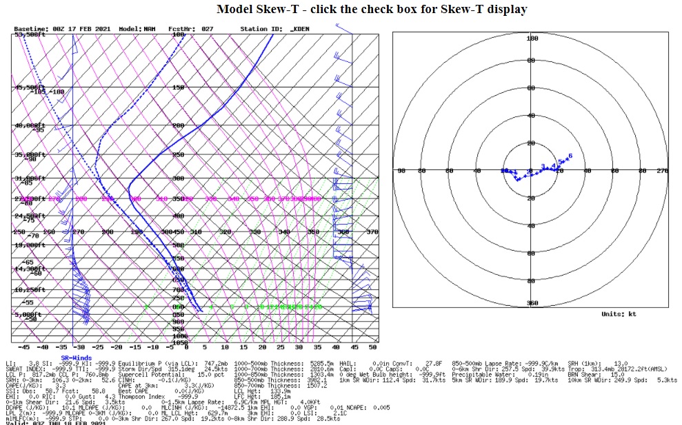
A combination of weak synoptic lift and upslope flow will result in in a period of mainly light snow from mid Wednesday afternoon through early Thursday morning. Taking a peek at the NAM model sounding for Wednesday evening shows upslope flow up to about 12500 feet, up to the Indian Peaks ridge line:
There seems as if there will be a weak circulation in the mid levels of the atmosphere which will help enhance the upslope flow. There is also some diffluence at 500 mb which should contribute to the weak synoptic lift. The NAM produces an impressive bullseye of up to -10 microbars/sec Wednesday evening over the northern Front Range Mountains:
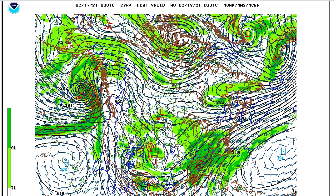
If real, this would lead to a period of heavier snow in Boulder and Larimer Counties. While this is not a big storm, we do have a few things going for us in terms of snowfall here in Ned:
1) Deep upslope flow (although it is weak)
2) Synoptic lift
3) Marginal moisture
4) An almost due easterly upslope wind
As for snow totals, here is what the different sources are saying:
1) National Weather Service – 2 to 4 inches
2) Weather Underground – 4 inches
3) DarkSky – 4 to 5 inches
4) Weather Prediction Center 50th percentile – 2 to 4 inches
I am going to go slightly above the concensus forecast with 4 to 7 inches of new snow.
It will continue to be cold over the next few days. Highs on Wednesday and Thursday will only be in the low 20s F with lows in the 5 to 10 F range.