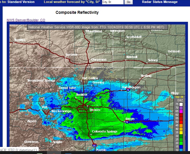
The storm has arrived in the Colorado Front Range Foothills. At 7 PM radar shows snow stretching from northern Boulder County southward to Colorado Springs. Note the sharp cutoff in precipitation between Boulder and Larimer Counties. This matches nicely with the latest snowfall forecast from the National Weather Service:
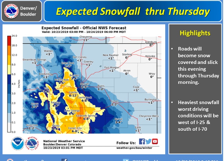
You’ll notice that the snowfall forecast for southern Boulder County has been bumped up slightly from last night’s outlook. Many of the ingredients are there for a decent early season snowfall. Here in Nederland we will be on the northern side of the storm, but with the upper level dynamics and upslope flow, 6 inches of snow (or slightly more) are possible before it all winds down early Thursday morning. This is a relatively fast moving weather system, and this will help to limit accumulations.