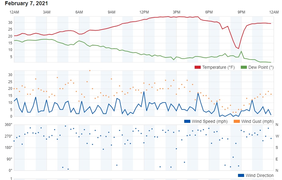
The cold pool of air that I mentioned in my last post continues to spin over southern Canada this evening. This has resulted in a marked difference in temperatures between the lower elevations of eastern Colorado and the mountain communities of the Front Range Foothills. While it has been sunny, mainly dry, windy, and mild here in Nederland, Boulder and Denver have been shrouded in a deck of clouds and mist with temperatures in the single digits and teens F. That is a classic inversion. The cold air briefly made it up to our home here east of Nederland at 8200 ft on Sunday night. The trace from my weather station shows the quick drop in temperatures followed by a warm up:
For about an hour the arctic airmass made it into Nederland and our temperature dropped 20 degrees F. However, it has been anchored on the Plains for several days now. I guess we are just lucky.
Not so fast. A reinforcing shot of cold air will sag southward through Colorado on Friday Night and early Saturday. The models – as always – have been waffling a bit on the strength and ultimate trajectory of the core of this cold air mass, but it looks like it will track close enough to Colorado to drop the temperatures in Nederland to near 0 F Saturday night with highs only (only) in the 5 to 10 F range on Sunday. It appears that there will also be some upslope snow Friday night through Saturday, but this will not amount to more than an inch or two of accumulation. This shot of cold air will be short lived. Temperatures should rebound by early next week.
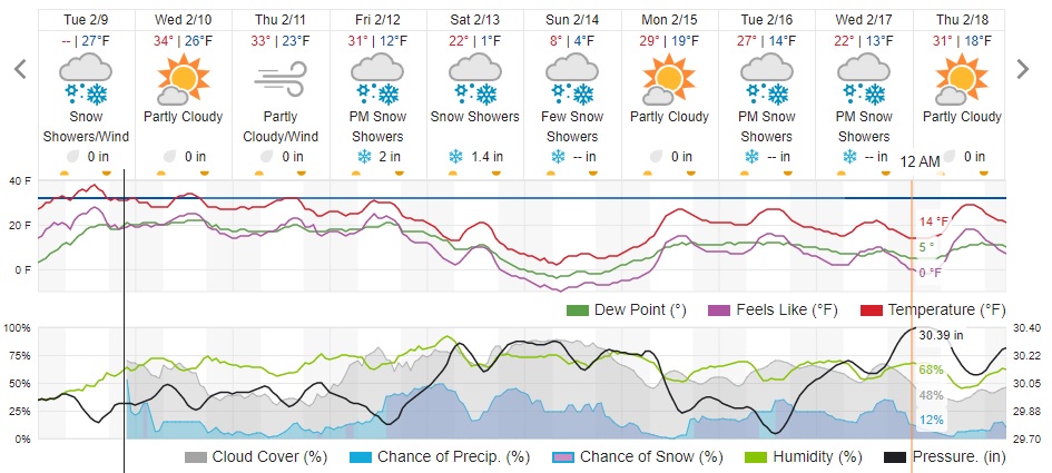
Here is the forecast from WeatherUnderground: