The forecast models are coming into better agreement about a storm that should bring much needed snow to the mountains of Colorado on Thursday and Friday. A moisture-laden trough from the West Coast will approach Colorado on Thursday. As it nears, lee side cyclogenesis will occur over eastern Colorado. This low will strengthen and then track east/northeastward across Kansas on Friday. The latest NAM is producing nearly 2 inches of liquid over the central and northern mountains of Colorado on Thursday and Friday:

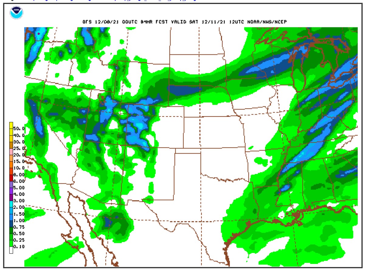
With the GFS looking similar:
Some places west of the Continental Divide such as the Park Range and the Flattops will likely see over 2 feet of new snow. However, this is not shaping up to be a big storm east of the Continental Divide in the Front Range Foothills. Nederland, Ward, and Rollinsville could see between 0.10 and 0.25 inches of liquid which with a 1:15 snow ratio would translate to 2 to 4 inches of snow, but this storm track and the expected wind directions are not favorable for significant snow for us. There was some hope that this could be the first measurable snow of the season for Denver, but the latest model runs are coming in drier for the Plains.
In the Indian Peaks and Rocky Mountain National Park, enough moisture should make it over the Divide to produce a decent snowfall. The trails around Brainard Lake are basically bare which is very unusual for December. Some areas in the Indian Peaks could see between 6 to 12 inches of snow, with a little more possible in Rocky. Here is the latest National Weather Service snowfall forecast. I think the totals east of the Continental Divide are too optimistic, particularly given the latest data and forecast storm track:

Behind this storm it will be chilly this weekend, but temperatures will warm next week with little precipitation expected.