Just a quick update tonight. Not much has changed with regard to the Thursday and Friday storm. It still looks like the mountains in western and northern Colorado – especially the ranges with good southwestern exposure – will see the most snow with this storm. East of the Continental Divide in the Front Range Foothills and here in Nederland, snow amounts will be much lighter. This is the latest 50th percentile snowfall forecast from the Weather Prediction Center:
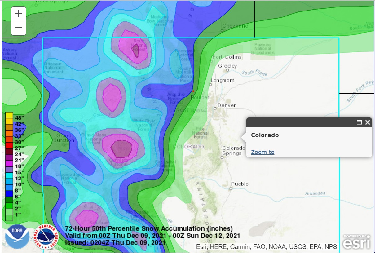
Notice the large snowfall amounts, particularly over the West Elks, San Juans, and the Routt National Forest. Also note the tight gradient of snowfall amounts on the east side of the Front Range. This forecast optimistically has Nederland in the 4-to-6-inch range. I think there will be marked differences in snowfall totals within 5 miles east or west of the Peak to Peak Highway. Locations such as Eldora, Ward, and Brainard Lake make see over 8 inches of snow. Locations a little east of a line from Ward through Nederland to Rollinsville may only see a few inches. Rocky Mountain National Park still has the best chance of double-digit snow totals.
This storm system has a lot of moisture associated with it. It will be interesting to see just how much snow makes it over the Continental Divide and into our neighborhood. Denver has still not had a measurable snowfall this season. Will they get 0.1 inches of snow with this storm? It is possible, but the forecast models have trended drier for the Eastern Plains.
For Nederland, Dark Sky is forecasting 2 inches of snow on Friday, while Weather Underground is calling for 1.1 inches. I think we will see between 1 to 3 inches, with larger amounts west of the Peak to Peak Highway.
After this storm system, it looks like things will dry out and warm up for us again here in the Front Range Foothills. It is shaping up to be a rough snow season for us.