The National Drought Monitor shows some good news for the Northern Colorado Front Range Mountains and Foothills including Nederland. The latest drought map has us as “abnormally dry” which is an improvement from late December when we were on the cusp of severe to extreme drought:

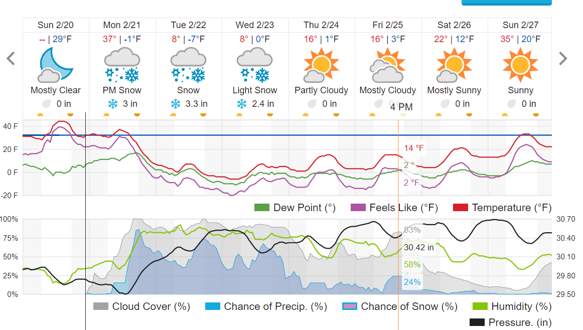
Since late December, we have been locked in a pattern of one snowstorm and cold air outbreak per week. This pattern will continue to hold this week as yet another round of snow and cold takes aim at Colorado. A slow-moving trough will dig into the Western US on Monday. Pieces of short-wave energy rounding the base of this trough will eject northeastward, tracking across Colorado, bringing periods of light snow. At the same time, a strong cold front will sag southward across Colorado Monday afternoon and evening. Behind this front, easterly upslope winds should help to focus light snowfall in the Front Range Mountains and Foothills.
This will be a prolonged storm event, starting Monday evening and continuing through Wednesday. It will not be snowing the entire time though. It looks like there will be three distinct periods of accumulating snow – one Monday evening, one Tuesday evening, and one Wednesday afternoon. Accumulations with each period of snow should be light, in the 2-to-4-inch range, bringing the 3-day total to somewhere in the 6-to-12-inch range. The latest NAM and GFS precipitation totals through Wednesday are 0.50 – 1.0 inches liquid which supports these accumulations.
While the snowfall should not be significant, it will be very cold with temperatures dropping to near -10 F Tuesday night and not getting much above 0 F on Wednesday:
After this storm, temperatures stay cold into next weekend. The Nordic skiing should continue to be really good on the Sourdough Trail and around Brainard Lake!