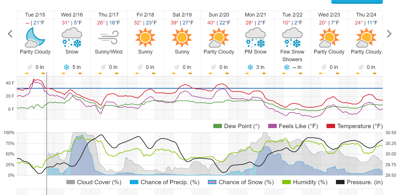
Our cold and snowy trend continues this week as yet another storm takes aim at the Colorado Front Range Mountains and Foothills. The atmospheric ridge over the Western United States that kept us so dry in December shifted westward in January, and this has allowed storm systems and their associated cold fronts to sweep across Colorado bringing plenty of snow and cold. We have been averaging about one storm per week here in Nederland and the surrounding Foothills communities.
The upper-level weather map for Wednesday morning shows the warm ridge off the West Coast with a deep trough digging into the Central and Southern Rockies:
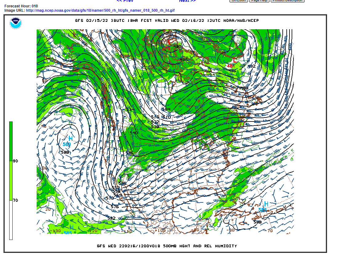
This trough will track across Colorado Wednesday and Wednesday night. The upper-level forcing associated with this trough combined with upslope winds east of the Divide will produce several hours of light to moderate snow in the Front Range Foothills. The latest GFS produces a bulls-eye of 0.75-inch liquid precipitation right over Nederland:
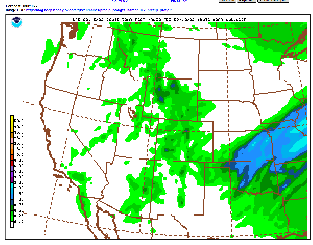
The latest National Weather Service snowfall forecast is showing:

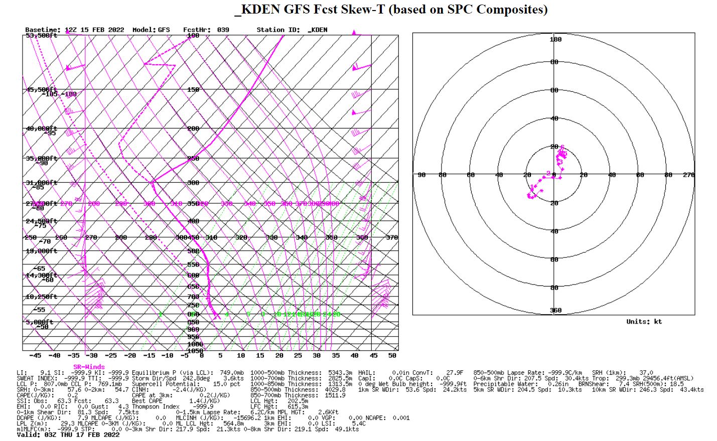
This places much of south and western Boulder County in the 6-to-8-inch range with a few locations reaching new 12 inches. The Skew-T diagram for Wednesday evening shows strong upslope flow of up to 20 kts up to 12000 feet which is high enough to flow over much of the Continental Divide. Because of this stronger upslope flow, I think heavier snowfall accumulations will be seen in the higher foothills and from the Peak-to-Peak Highway to the Divide.
The timing of this storm is much like the one we experienced last week. It will likely impact the evening commute. Expect road conditions in Boulder Canyon to once again be dicey in the evening.
After this storm we are in for a sunny and milder weekend. But there is yet another storm on the horizon for early next week: