After a few weeks of relatively calm weather, wind is returning to Nederland and the surrounding Foothills communities on Wednesday and Thursday. The NAM upper level soundings are showing some impressive winds, especially Wednesday night:
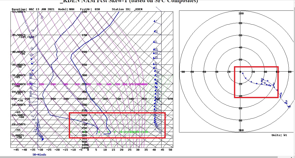
This is showing 55 kt sustained winds for Wednesday night with gusts up to 70 kts possible. This could be our strongest wind event of this winter season, and just when we were thinking that this La Nina was lacking some bite.
The National Weather Service has issued a High Wind Watch effective from midday Wednesday until midday Friday for northwest winds of 30 to 40 mph with gusts up to 80 mph.
The energy associated with this wind event will in large part becoming from an upper level shortwave passing to our north Wednesday night and Thursday:
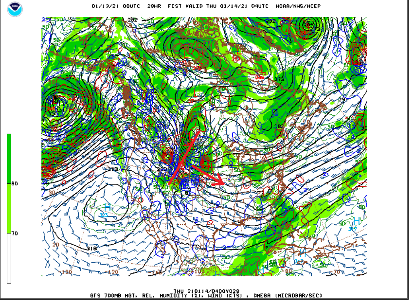
The main low is well to our north over southern Manitoba, but the tight pressure gradient between this storm and a ridge of high pressure off of the California coast extends into the Central Rockies. This pressure gradient will help to accelerate the northwesterly winds and they will gain momentum as they cross the Front Range Mountains.
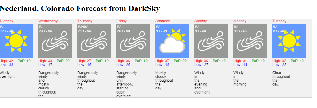
Aside from the wind, there is little in the way of precipitation in the forecast: Here is my experimental forecast product based on the DarkSky API:
Hold on to your hat!