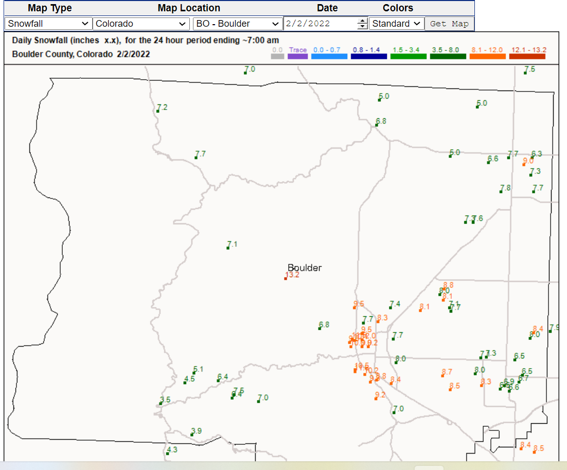
Yet another storm brought moderate snowfall to the Colorado Front Range Mountains, foothills, and the adjacent plains. The heaviest snowfall amounts were reported in the lower Foothills and the nearby plains. The town of Nederland only saw between 3 to 4 inches of snow while at our house 4 miles east of Nederland, we received 6.6 inches. A few locations in Boulder reported up to 12 inches. This was a classic example of a very cold, mid-winter storm that produced more snow on the Plains than in Nederland and the Front Range Mountains:

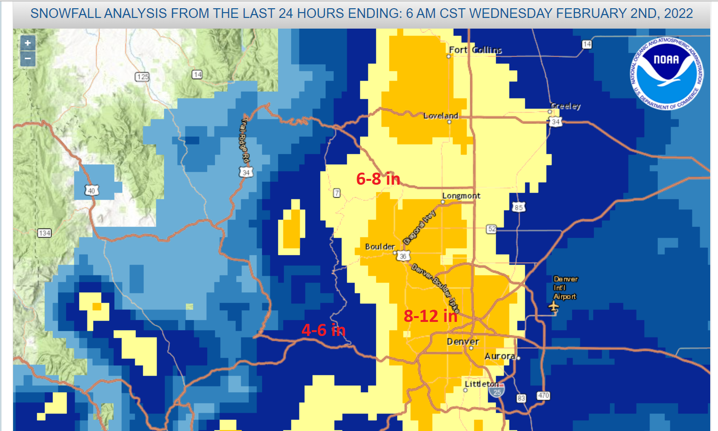
Most areas saw around a 15:1 snow ratio. The SNOTELs on the east side of the Divide (Niwot, University Camp, Lake Eldora) all show between 4 to 6 inches of new snow. Here is the National Weather Service snowfall analysis:
Again, the lower elevations saw some of the best snow totals.
Behind this storm, we are experiencing some chilly temperatures. As of this writing at 10 PM Wednesday night, it is -14 F (or 14 degrees F BELOW zero). I have a friend that lives in Fairbanks, Alaska, and -14 F is not cold for them, but it is a bit nippy for us. Here are my observed minimum temperatures by year from my records:

-14 F is about as cold as it gets here. There have been three years where we dropped below -20 F, but that is pretty rare. There are some big variations in minimum temperatures around Nederland. We live on a ridge and do not get nearly as cold as some locations along South, Middle, and North Boulder Creeks do. For example, in 2011 when we bottomed out at -26F, some locations in Cold Springs dropped to -35 F!
We are in for a period of cool but settled weather:
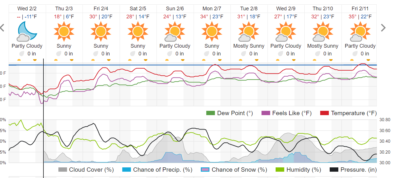
February tends to be one of our snowier months with an average of 28.8 inches. The next three months will make or break our snow season.