Did I mention that weather forecasting is tricky business, especially here in the Southern Rockies? I’m not whining (at least I don’t think I am). This is what makes Colorado such a fun place to live! The models continue to struggle with a complex storm system which will be impacting our weather starting tonight and continuing through Saturday. You would think that the numerical models would have a good grip on a storm system expected to start in a matter of a few hours, but there are still plenty of unknowns. Also, lee side cyclogenesis can be very difficult to forecast for a human or a computer. We live in a special place when it comes to storm development. If you were to examine all of the locations in the North American continent where storms are born (cyclogenesis) you would begin to notice that there are several areas where storms tend to develop:
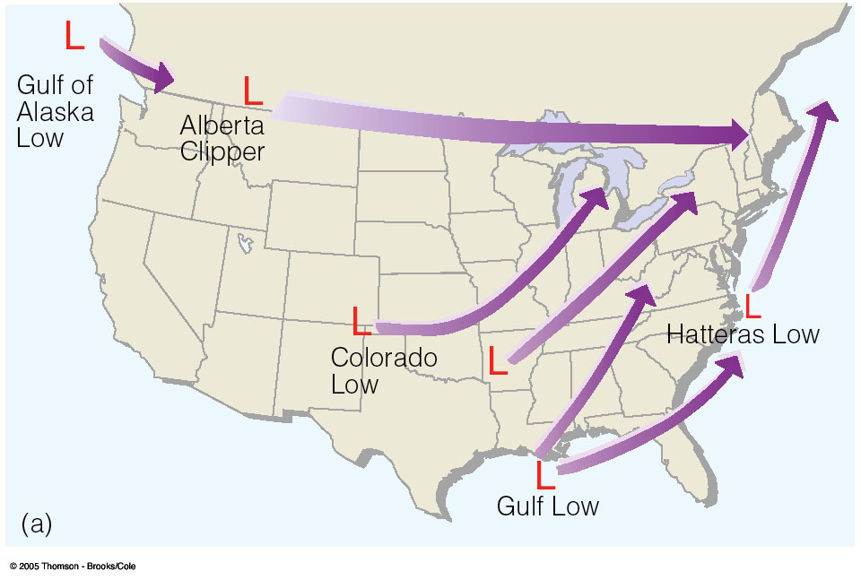
One of these places is right in our back yard (or front yard depending on your perspective). Storms tend to form in eastern Colorado and then track to the east northeast. As storms approach from the West Coast and encounter the Rockies, they weaken. When the associated upper level energy reaches the Great Plains, these storms tend to redevelop and strengthen. If you do a web search on lee side cyclogenesis, you will see some technical explanations as to why storms tend to redevelop on the east side of mountain ranges in the Northern Hemisphere. These explanations will include terms such as conservation of potential vorticity.
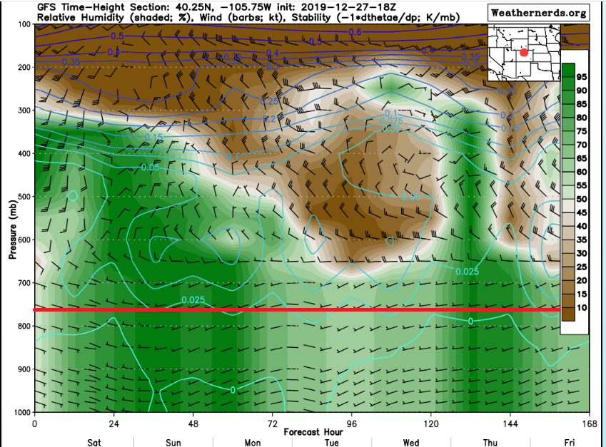
Back to our weather, a storm system is expected to develop over northeastern New Mexico tonight and then strengthen over western Kansas on Saturday. The exact track this storm takes and when it decides to deepen will greatly influence the timing of and how much snow we receive. The 18Z midday Friday GFS model time height plot continues to show plenty of moisture over Nederland right through Sunday. With this model, run there is a deeper layer of easterly upslope winds along the Front Range:
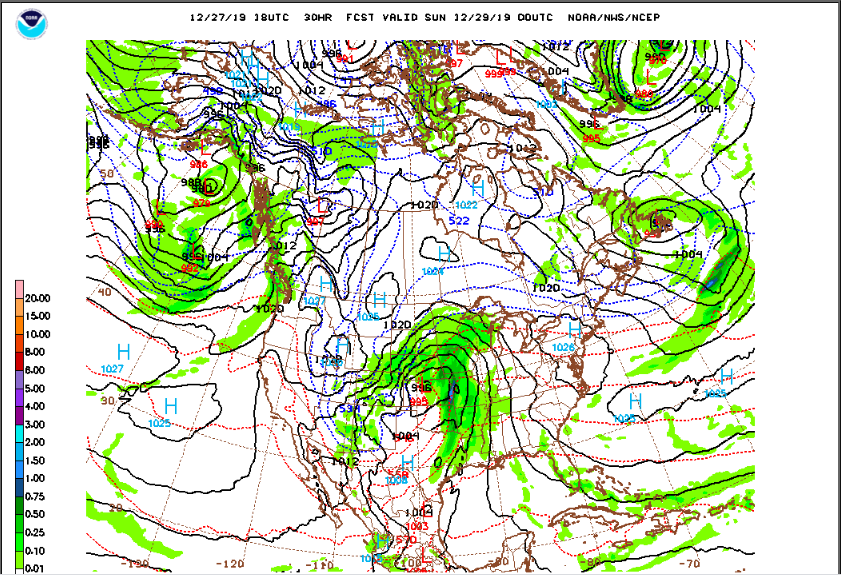
But the 18Z NAM is telling a different story with a storm that is tracking a bit farther to the east. Take a look at the storm position Saturday evening on the GFS:
versus the storm position shown on the NAM:
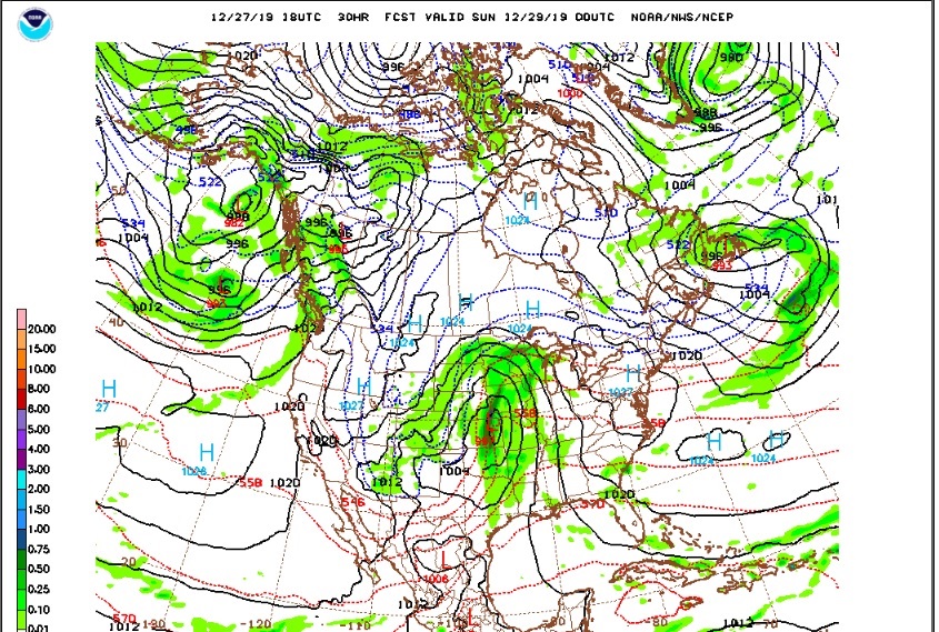
The GFS has the storm centered over north central Kansas while the NAM has it positioned over Kansas City. This is a difference in position of about 200 miles.
Overall, the GFS has been less consistent with the handling of this system, and I am still favoring lower end snowfall amounts for Nederland and the surrounding Front Range Foothill communities. At the moment, the National Weather Service is calling for 2 to 4 inches of snow for us, DarkSky about 7 inches, and the Weather Prediction Center’s 50th percentile forecast is for about 2 inches. Weather Underground is showing about 4 inches:
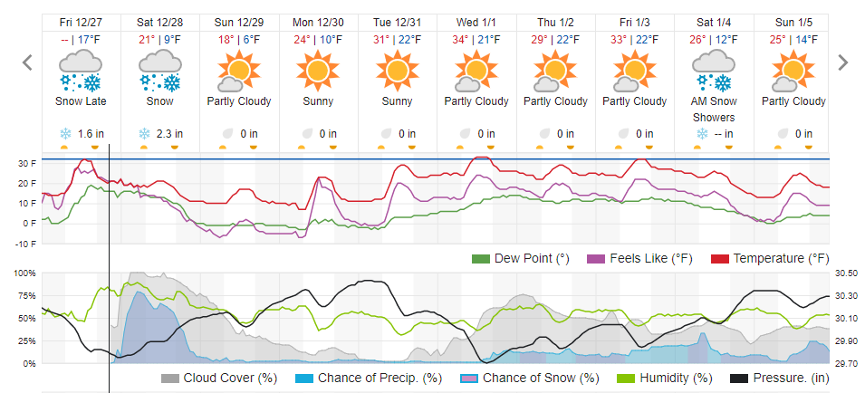
Given all of the data 2-4 inches seems like a good bet. It will be interesting to see which model “wins” tonight and Saturday.