Holy cow! We have weather to talk about! And just in time for the holidays!
If you like cold and white Christmases then you should enjoy Christmas 2017. After a few more days of unseasonably mild temperatures, a cold front will push through Colorado Wednesday Night with upslope snows developing just in time for the Thursday morning commute. The snow will continue through Thursday followed by a brief break in the action on Friday. Another cold front, this one the harbinger of an “arctic” airmass, will sink across Colorado late Friday, accompanied again by a period of light snow which will last into Saturday. Temperatures over the weekend will plummet, with lows Sunday morning well below 0 F. All said, it looks like temperatures will remain below freezing from Thursday at least through Wednesday of next week.
We are not talking about a lot of snow, but it will accumulate through the weekend with no opportunities to melt. It will be enough to whiten the ground and make the roads slick at time. After our prolonged period of “no weather” and mild temperatures, this will be a reminder of what winter can be in the Central Rockies.
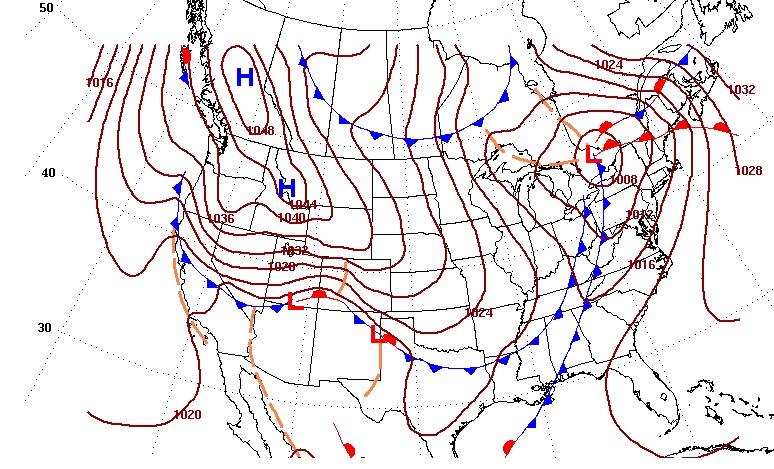
The following map shows the forecast location of pressure systems and fronts on Saturday morning. The dominant feature is the 1048mb area of high pressure pushing into northwestern United States with the cold front stretched along southern Colorado and cold upslope flow across Northeastern Colorado.
In short, be prepared for a big change in our front range weather, and stay tuned for snow accumulation forecasts.