After a few days of mild weather here in the Colorado Front Range Foothills, a sharp drop in temperatures and even some snow are on the way for Easter Sunday. This cold and unsettled weather is expected to continue through much of next week. Hopefully, you enjoyed the warmer weather while it lasted. Welcome back to spring in the Rockies.
A strong cold front will sag southward across Colorado Saturday evening. As much colder air flows into northeastern Colorado, moist, northeasterly upslope flow will set up along the Front Range Foothills. Snow will soon follow. Right now, it looks like snow will fall steadily from around 1 AM Saturday morning through much of Sunday afternoon. During this time, temperatures will also be plummeting into the 10-15 F range. We are supposed to be sheltering in place and social distancing – a Rocky Mountain Easter snowstorm should help with that.
Here is the QPF forecast from the Weather Prediction Center for this storm:
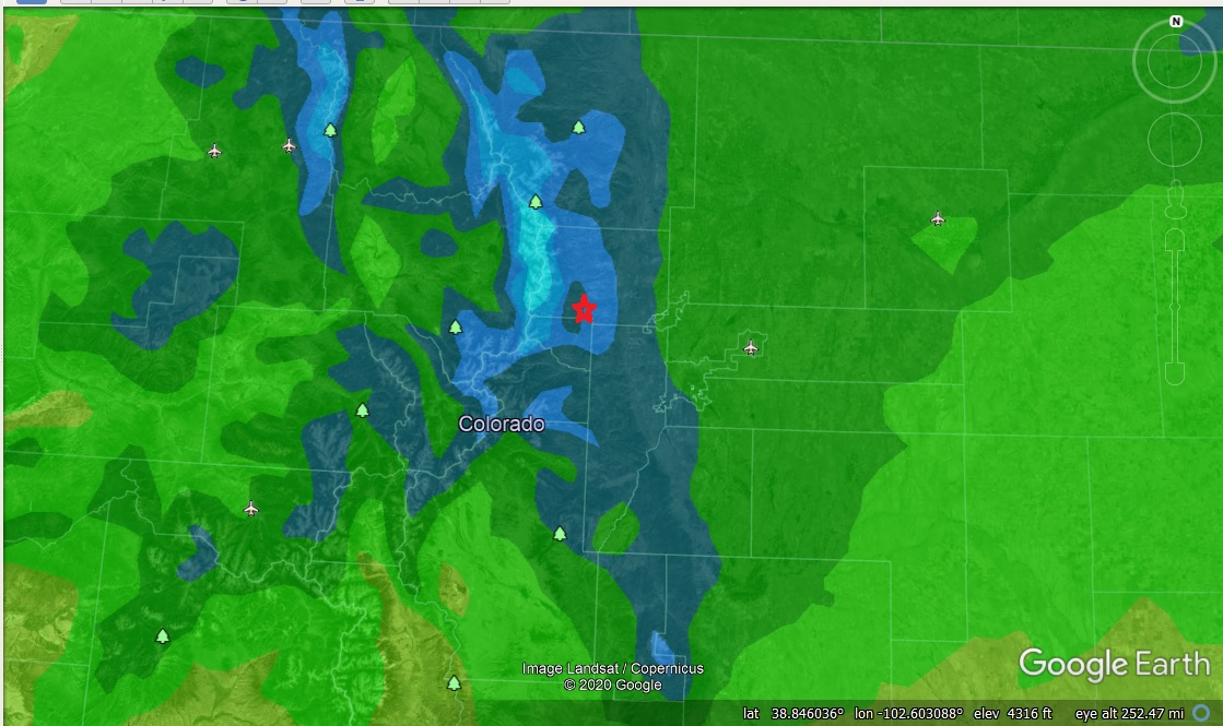
The red star shows roughly where Nederland is. The dark blue is 0.50 inches of liquid while the lighter shade of blue is 0.75 inches.
Here is the probability of getting at least 4 inches of snow here in Ned:
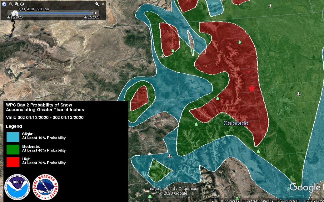
Again, the red star is about where Ned is on this map. Here is the probability of snowfall greater than 8 inches:

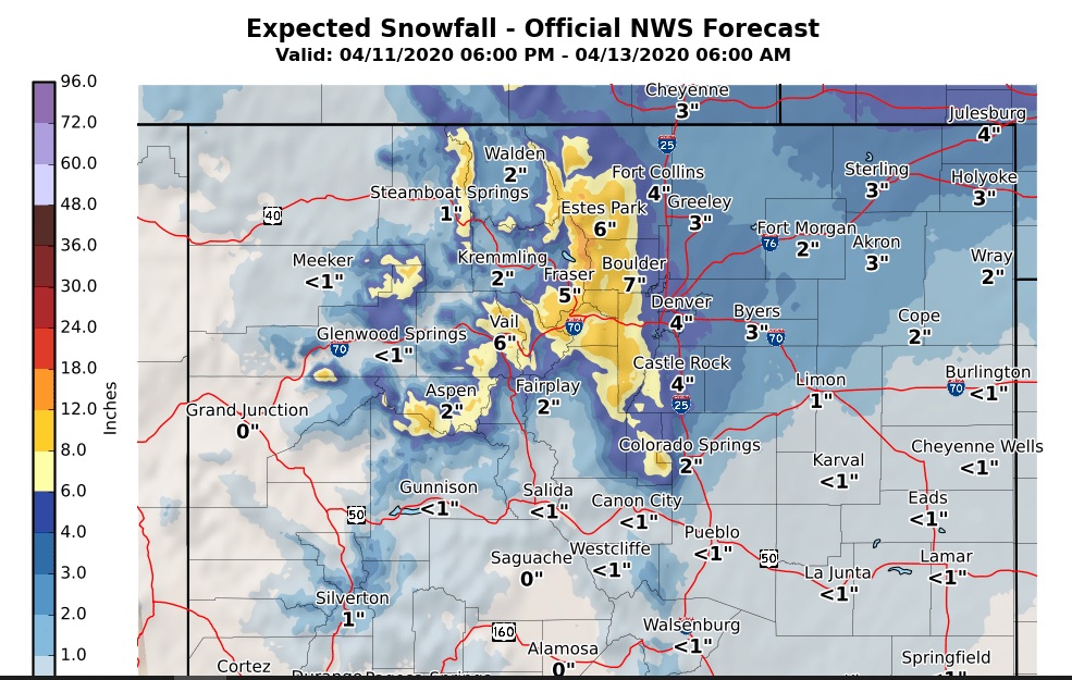
The National Weather Service has issued a Winter Weather Advisory for the Foothills for Saturday night and Sunday for 5-12 inches of snow. Here is their latest snowfall map:
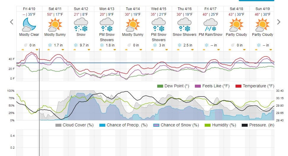
Dark Sky is calling for 10 to 15 inches while Weather Underground is looking at around 12 inches:
When tracking storms not only do I like to look at the model data, but I also find it helpful to look at other sources of forecast information (National Weather Service, TV, DarkSky, Weather Underground, etc.) to come up with a consensus forecast. Consensus is usually pretty good, and you can add skill by beating consensus. For example, the consensus snowfall forecast is 8 to 12 inches. The question is is this too high, too low, or just right?
Looking at the latest model data and trends as well as the upper level model soundings, I am inclined to go for 4 to 9 inches. I am not impressed with the depth of the moisture with this system, but the temperatures should be conducive to good snowflake growth, and we could get a 1:12 or even 1:15 snowfall ratio. Even if we only see 0.50 inches of liquid, that would amount to 7.5 to 10 inches of snow. Also, the atmosphere is more unstable in April.
Incidentally, CBS Denver is reporting that this will be the coldest and snowiest Easter in Denver since 1928:
https://denver.cbslocal.com/2020/04/10/denver-weather-easter-snow-coldest-92-years-colorado/
Aside from the snow, it will be downright cold on Sunday night with lows of 5 to 10 F!