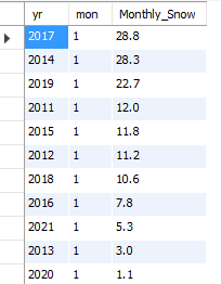
As I mentioned in my last post, our snowfall for January was a measley 5.3 inches but that was not the least snowiest January in my records:
Temperature wise January was a little colder than normal in our neck of the woods. Our average high was 34.7 F with an average low of 17 F and an overall average temperature of 25.3 F. Our normal January high is 35.6 F, low 17.8 F, and average for the month is 26.4 F. In the end, January 2021 was 1.1 F below normal. It was also drier than normal.
Our weather over the next several days will be dominated a pool of cold air and its associated upper level circulation over southern Canada. This circulation affectionately know as a Polar Vortex represents some of the coldest air of the season on the North American continent. Is it really a Polar Vortex. No, not really – it is a term drummed by weather people on the East Coast where any weather-related phenomenon needs an attention-getting, news-making headline.
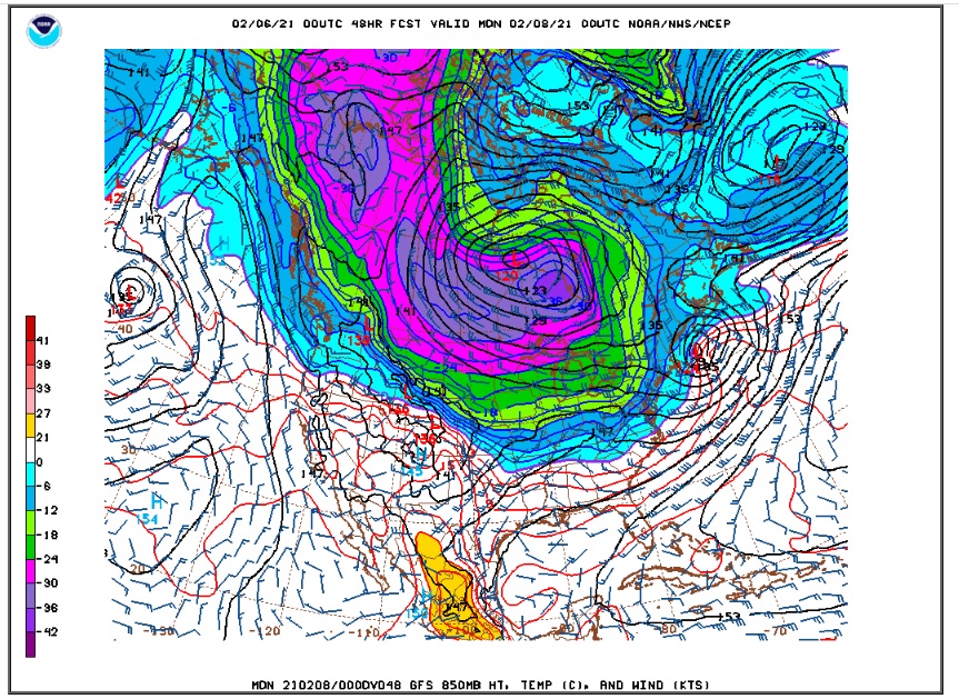
Here is an 850 mb temperature map showing this mass of cold air with temperatures down to -40 C near the southern Hudson bay area on Sunday evening:
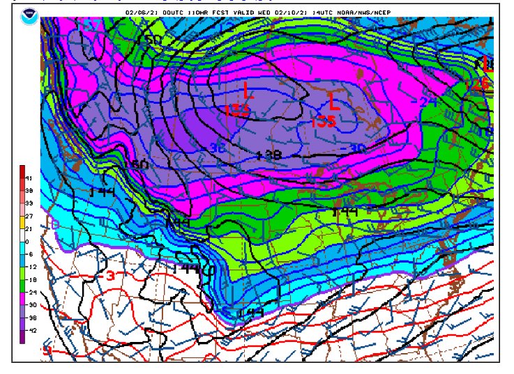
This air masses remains pretty much in place, perhaps pushing westward a bit by Wednesday:
We in Coloado stay on the southern fringe of this air mass at least through the middle of the week. By the way, it is not a coincidence that the jet stream is lining up with this thermal gradient (or temperature boundary) draped from west to east across the country:
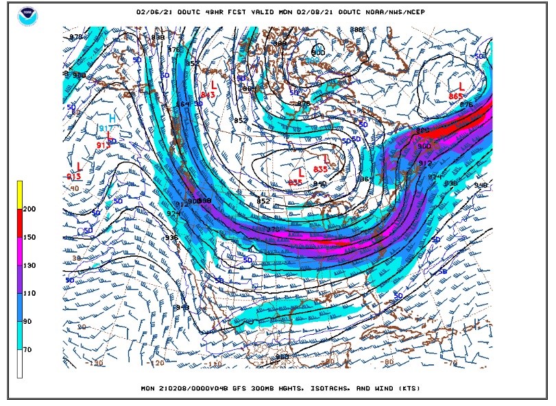
The jet stream is strongest over sharp horizontal temperature contrasts (or gradients) in the atmosphere. Also, this west to east flow is also known as zonal flow. It is not highly amplified into troughs and ridges that are normally associated with storms. What it means for us is simple. Most snow that does fall will be on the west side of the Continental Divide. We will get wind and occasional periods of light snow and flurries here in Ned. That is about it.
La Nina has weakened somewhat over the past few weeks. The latest ONI 3.4 index is down to -0.7, and there are signs of warming in the eastern Pacific My hope is that La Nina will weaken enough as we head into spring to finally let in some storms and moisture in the Central and Southern Rockies..
Here is the DarkSky forecast into next week:
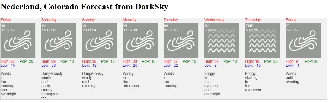
You might notice the below zero F forecast low temperatures on Thursday and Friday. The models have been hinting at that cold Canadian airmass eventually sinking southward from Canada into the United States. But they have not been consistent in the handling of this. More on that in a later post…