The forecast for Nederland over the next few days is beginning to look a bit more interesting. Since my post last night, it is now appearing that the storm may come in a bit stronger and last longer. The models had been advertising this as mainly a Saturday night through Sunday snow event. They were showing a second, but smaller round of snow on Monday afternoon: Here is the Weather Underground forecast from last night:
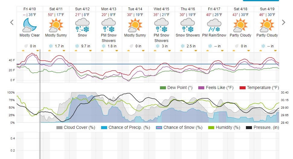
Here is the current Weather Underground forecast:
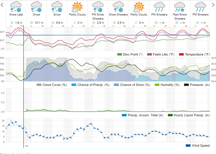
Notice that the forecasted snow amount for Sunday has not changed that much, but now it appears that snow will continue through Monday. If you add up the numbers, the two day accumulation is 17.6 inches! Dark Sky puts out 24 inches.
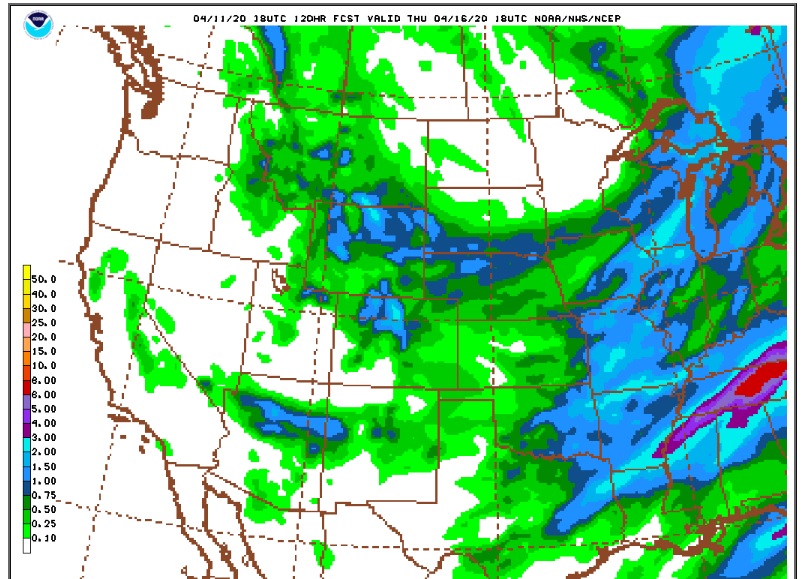
Looking at the midday Sunday (18Z) GFS model, there is a bulls eye of 2.0 inches of liquid precipitation over the Northern Front Range mountains:
This is an extremely complicated forecast because it revolves around jet stream dynamics which often results in bands of heavy precipitation. Where these bands set up it can snow a lot, but forecasting exactly where these bands will become established is tough. A strong cold front will push southward through Colorado early Sunday morning. This will result in easterly (on Easter) upslope winds with a decent amount of moisture. Northeastern Colorado will be in the rear left exit region of a jet streak for much of the day, and this should enhance lift and snow production. The combination of moist, upslope winds and forcing from this jet streak will result in snow for a good part of Sunday. Here are the winds at 300 mb on Sunday morning. Note the jet streak nosing into northern Colorado:
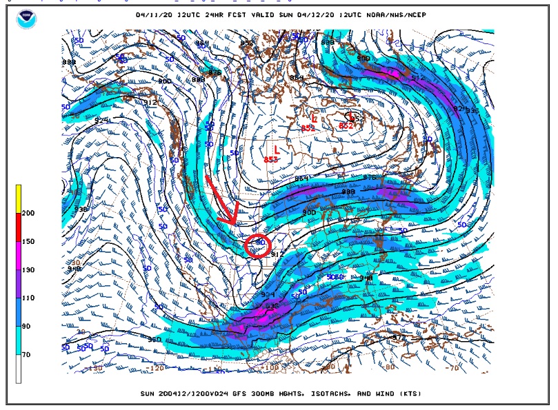
I’ve circled northeastern Colorado. By Monday morning we are in the front right entrance region of this same jet streak:
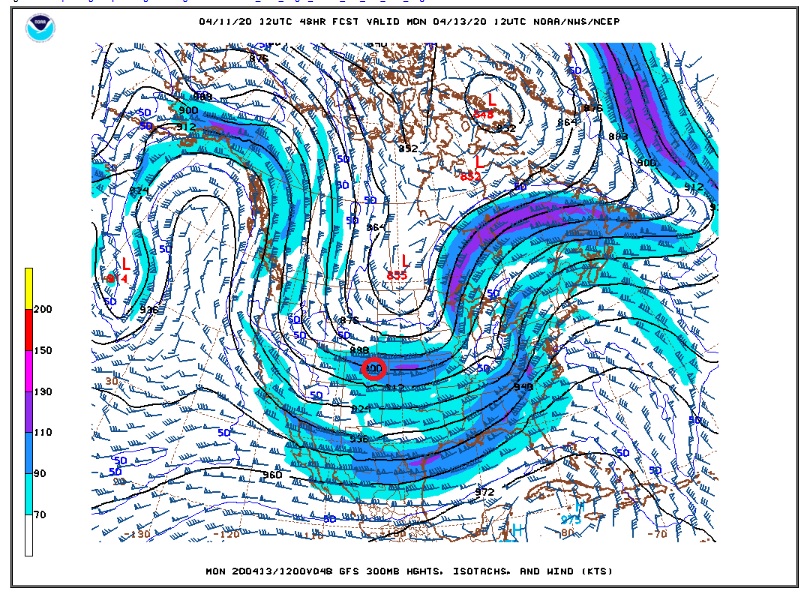
The fact that we start out in the rear entrance region of this jet streak and end up in the front entrance region gives this storm its two bursts of snow, one on Sunday and one on Monday.
The National Weather Service’s low end (90%) snowfall forecast for us is 6 to 8 inches and high end is 12 to 18 inches while their official forecast is 8 to 12 inches. The ingredients are all there for a big snow event but the big question is if they will all come together. I have bumped up my forecast up to 10 to 14 inches, but there is still a lot of boom and bust potential.