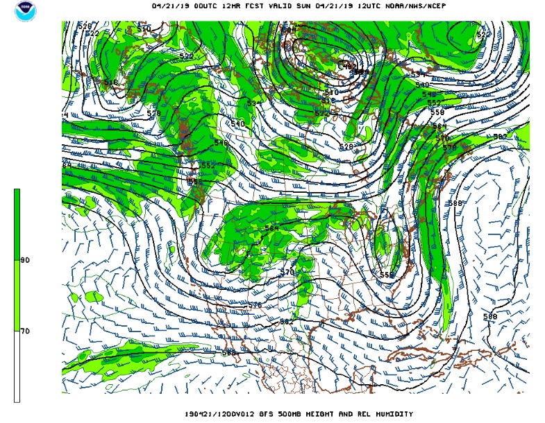
As promised, Friday and Saturday featured mild and dry weather along the Front Range Mountains and Foothills. Friday brought a picture-perfect blue sky, the kind you see on postcards and the kind Colorado is famous for. On Saturday, there were a few more clouds. Initially they were high clouds on the lee side (downwind) side of the Continental Divide. As the day progressed and more atmospheric moisture streamed into Colorado, the clouds billowed and produced streamers of precipitation, most of which did not reach the ground. When clouds precipitate but it does not reach the ground, this phenomenon is known as virga. The precipitation is evaporating, and this is a good indicator how dry the lower levels of the atmosphere are. The increased moisture and cloudiness on Saturday were in advance of our next weather maker, a trough of low pressure and colder air pushing across the Western Great Basin. This map shows the position of this storm on Sunday morning:
As this trough approaches on Sunday, a surface low will form on the Colorado Eastern Plains. As this storm deepens, easterly upslope flow will focus cooler and moister air along the Front Range Mountains and Foothills, and this will result in widespread rain showers and perhaps a few rumbles of thunder in and around Nederland Sunday afternoon and evening. In general, the forecast models are predicting somewhere between 0.50 and 1.00 inches of liquid precipitation with this storm system. As colder air works into Colorado Sunday night, the rain will likely change to snow. This is where the forecast gets a bit more tricky. The timing of the rain to snow change over will determine how much accumulation – if any – Nederland and the surrounding Foothills communities will see.
I suspect that by the time it gets cold enough for snow, probably between 10 PM and Midnight Sunday night, much of the precipitation will be over. This should limit accumulations to under an inch. With the ground being so warm, any accumulation will be on grassy surfaces, decks, and tree limbs.
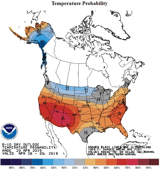
Monday morning will see temperatures around 30 F and highs will struggle to get to near 40 F by the end of the day. Brrrrr! But it is late April in the Rockies. The cooler temperatures will be short-lived.It will all be just a distant memory by mid week when warmer weather returns. The 6 – 10 day outlook from the Climate Prediction Center promises more unseasonably mild weather: