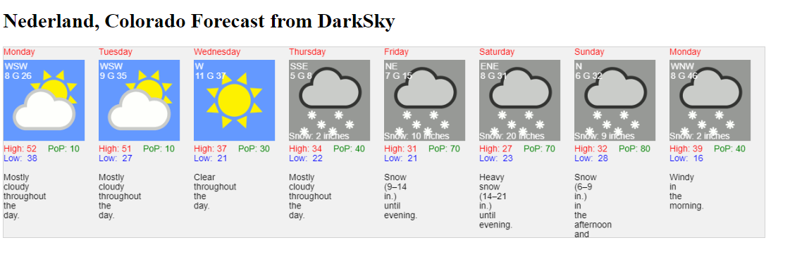
I wanted to briefly mention that the high temperature reached 53 F here in Nederland today, but obviously this taste of spring is not what is on everyone’s mind right now. A return to colder weather is expected later this week, and a prolonged period of snow starting later Thursday and continuing through much of the weekend is possible. This weather event is still several days off, but it is fun to look at some of the snow totals that various sources are producing:
DarkSky: 42 inches
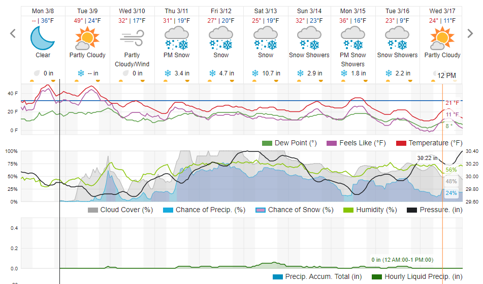
Weather Underground: 24 inches
Here are the graphical products including my experimental DarkSky product:
Weather Underground
Many of the ingredients for a big snowfall in the Colorado Foothills east of the Continental Divide appear to be available, but the question is whether or not they will come together just right to produce a big snowfall for us here in Nederland. A storm system currently in the Gulf of Alaska will dive southward into the Great Basin by Thursday. Then, the big question mark is the exact track and speed of this deep upper level cutoff low as it crawls eastward from the Great Basin over the Southern Rockies this weekend. The models have different solutions which lead to a diverse range of precipitation amounts in the Colorado Front Range Foothills.
As the storm approaches the Continental United States and enters a more observation rich area, the models should start getting a better grip on how this system will move and its strength will evolve over time. For the moment, I will try to maintain a healthy skeptism (from a weather forecasting perspective), aknowledging that there is still plenty of uncertainty. Still, this is where weather forecasting is fun! And if we did get this moisture, it would certainly help with our drought.
Before the storm, we will have one more day of mild weather on Tuesday when temperatures should rise back to near 50 F. Colder air starts to filter into Northern Colorado on Wednesday with highs in the 30s F and lows around 20 F. And then things may get interesting…
I’ll post an update Tuesday night. If you are a snow lover, keep your fingers crossed!