The Weathernerds GFS loop of 750 mb temperatures shows our latest spell of warm weather exiting to our east on Christmas Eve with colder air settling into Nederland and the surrounding Front Range Foothills communities on Christmas Day and Thursday:
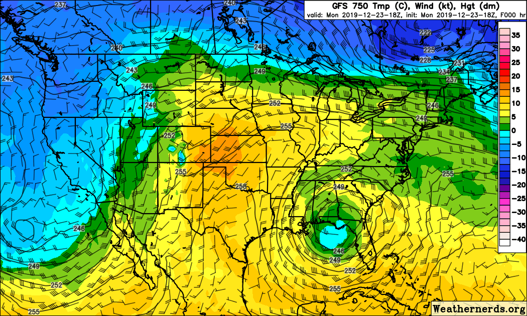
I picked the 750 mb map because this is level roughly matches the elevation of Nederland, that is, 8200 feet. If you look closely at the animation you will see a low crossing far southern California on Thursday morning. This system is expected to track across the far southern Rockies on Friday. As this system tracks eastward, a deep storm system may develop on the Great Plains on Saturday, and this storm could bring copious amounts of snow and blizzard conditions to portions of the Northern Plains and upper Mid West. This of course depends on which model you believe. The ECMWF tracks this storm even farther south and is weaker. Neither the GFS or ECMWF solutions have much impact on Nederland and the Front Range Foothills.
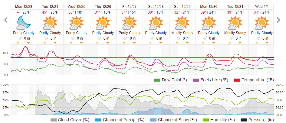
Back here in northeastern Colorado, expect highs on Tuesday to be in the low 40s F, which is about 10 degrees cooler than they were on Monday. Highs on Christmas will be in the mid 30s F which is seasonable for late December here in the hills. These normal temperatures should continue through the end of the week.
As the bulk of the cold air pushes in Tuesday night and Wednesday morning, a period of light snow will be possible, mainly on the west side of the Continental Divide. A few flakes of snow may make it over the Divide into Nederland, but not much accumulation is expected. Here is the Weather Underground forecast for Nederland:
In a nutshell, the weather will be dry and seasonable at least into next week!