This past weekend’s storm left 4.6 inches of snow at our home just east of Nederland which is by no means a large snowfall compared to what Nederland can see. However, small storms like this one are what we typically see in late December and January when it is rare to get more than 9 inches of snow at a time. While most areas in the Foothills saw similar amounts as us on Saturday, surprisingly it wreaked havoc with traffic in Boulder Canyon. I say that because our early fall and late spring storms generally seem to have the biggest impact on travel because the pavement is warmer at these times of year. A typical early autumn snowstorm starts with air and pavement temperatures above freezing. As the snow melts on the pavement thermodynamics take over, and the latent heat of melting and sublimation act to quickly cool the ground to close or slightly below freezing. Remember, it takes energy to melt ice, and this energy comes from the environment. As the roads cool, the snow starts to stick. However, water is a special substance which expands when it freezes to ice. If pressure is applied to ice which is at or slightly below 32 F (0 C), it will turn back to water. This can have major implications on travel. As vehicles travel on snow-covered roads, their tires momentarily cause the snow to melt to water. As soon as the the vehicle passes, the water instantly refreezes to ice. Eventually, you have an ice-covered road with snow on top of it. Our first snow of this season was in early October, and I had an anti-lock brake adventure in Boulder Canyon right about where the grade approaches 10%. Adrenaline is better than caffeine, particularly at 5 AM!
Northern facing and forested slopes around Nederland, which is at about 8200 feet, have now had an inch or more of snow on the ground for 59 days this fall. This is above average when compare to other years this decade:
| Days | Year |
|---|---|
| 59 | 2019 |
| 50 | 2018 |
| 24 | 2017 |
| 28 | 2016 |
| 47 | 2015 |
| 35 | 2014 |
| 24 | 2013 |
| 21 | 2012 |
| 69 | 2011 |
The New Years Eve and New Years Day forecast still looks to be dry but cold for Nederland and the surrounding Foothills communities. Highs on Tuesday and Wednesday will flirt with 32 F with lows in the 10-15 F range. A reinforcing shot of cold air will sweep through on Thursday and Friday, and this will keep daytime temperatures in the 15 to 20 F range.
At this time there are no big storms on the horizon. The 6-10 day temperature and precipitation forecast from the Climate Prediction Center shows near to slightly below temperatures and precipitation for us:
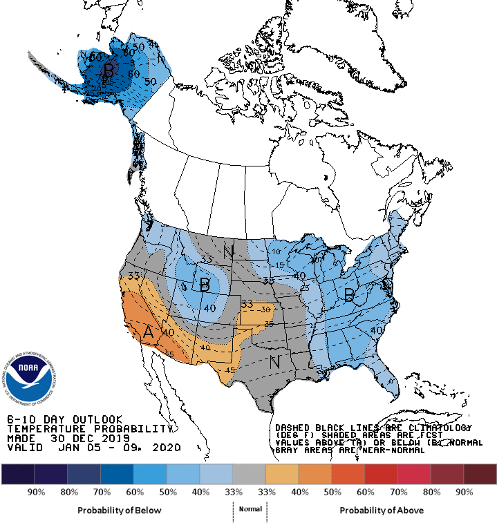
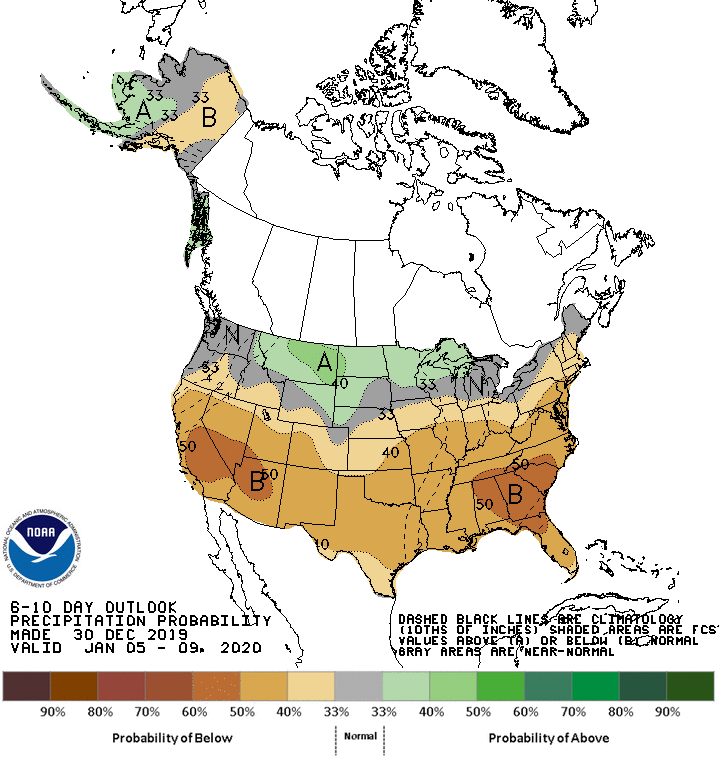
This is not exciting by any stretch of the imagination … Did I mention that January is one of our drier months?
It is worth mentioning that several sheltered mountain valleys in Northern Colorado were numbing cold last night. The National Weather Service tweeted that Antero Reservoir bottomed out at -48 F!!! That was colder than Fairbanks, Alaska.
Happy New Year!