After weeks of tranquil weather, there is finally something to talk about. The storm is pretty much on track, and there are not any major changes from my last forecast. After a beautiful Sunday with temperatures topping out at 56 F at my home weather station, colder air is already starting to advect on northeasterly winds here in Nederland and the surrounding Foothills communities, and it is already 26 F. As moisture slowly pushes into northeastern Colorado, clouds will develop and lower, and we should find ourselves in a thick bank of freezing fog and drizzle by morning. Snow will not be too far behind, and by midday it should be snowing steadily. Snow will continue through much of Monday night into Tuesday. By the time the storm winds down on Tuesday, we should see anywhere from 6 to 10 inches of new snow. Here is the latest forecast from the National Weather Service:
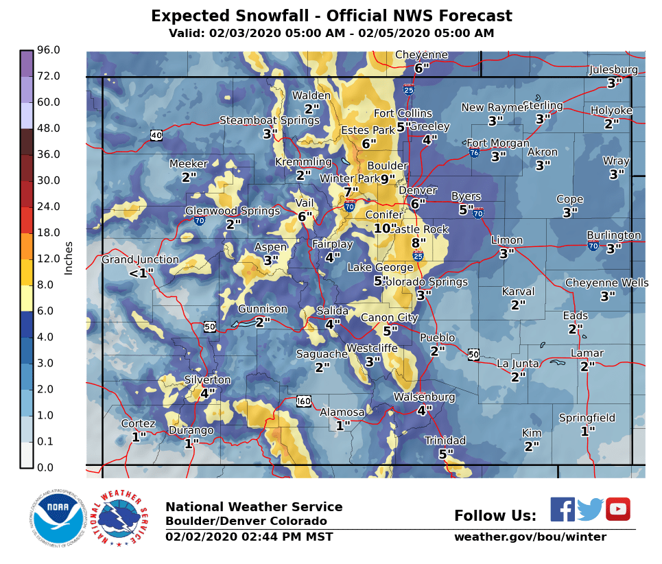
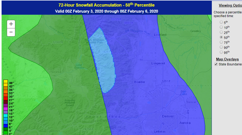
And this puts us in the 8 to 12 inch range. The Weather Prediction Center’s 50th percentile snow forecast has us in the 6 to 8 inch range:
Overall, this is expected to be a moderate impact event, making roads slick for both the morning and evening commutes. The heaviest snow with this system will be focused east of the Continental Divide.
We’ll keep you posted as the storm progresses!