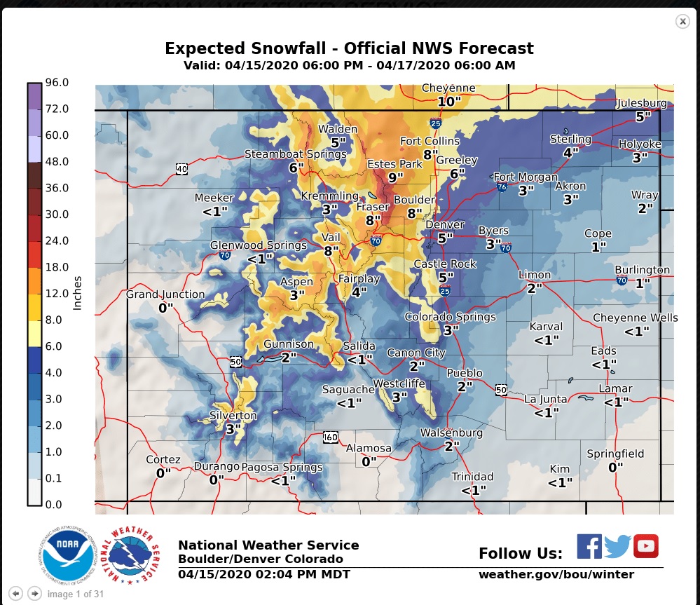
Nederland and the surrounding foothills communities are still in for a round of cold and snow starting tonight and continuing through Thursday evening. Since my last post, there has been a trend towards higher snowfall amounts. The GFS model continues to put out anywhere from 1.50 inches to 2.0 inches of liquid precipitation in Nederland northward towards Estes Park. At last check, Weather Underground is calling for 15.2 inches of snow for us while DarkSky is calling for anywhere from 18 to 27 inches. DarkSky tends to be a little bit “out there”, so I am ignoring those totals even though they are fun to look at. Everything else I am looking at supports 10 to 18 inches which is about what the National Weather Service is calling for us:
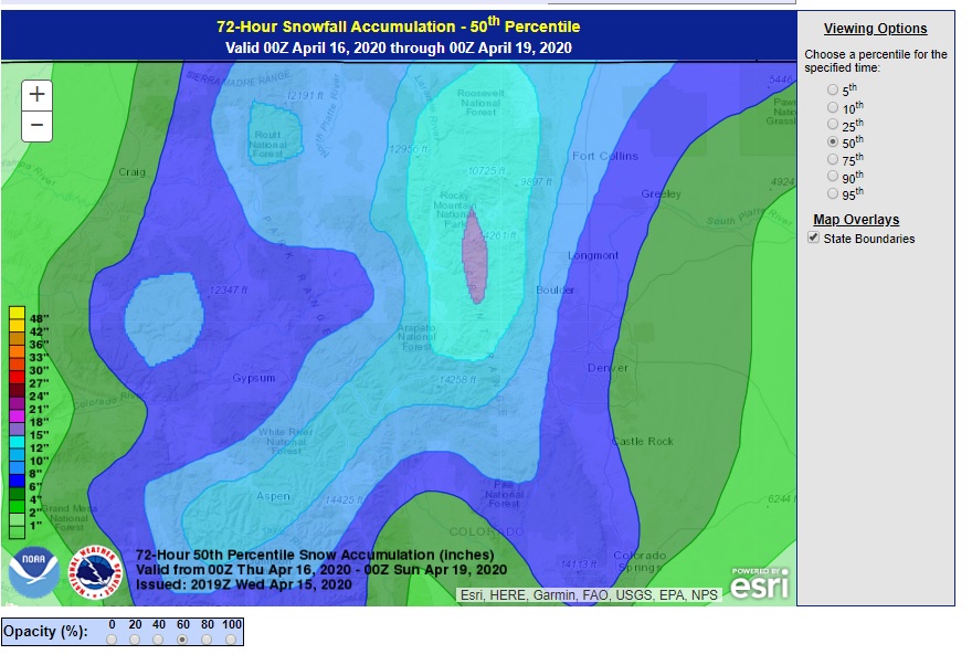
The Weather Prediction Center 50th percentile snowfall forecast puts us at 12-15 inches:
The heaviest snow should be from about 10 PM tonight through 9 AM tomorrow morning. It will continue to snow during the afternoon, but it should be lighter. As I mentioned in my last post, temperatures will be in the 15 F to 24 F range for the bulk of the storm.
We’ll see what happens. Storms rarely behave exactly according to the forecast, and the models have had a hell of time with this one!