Wow! My official measurement from the Wednesday night/Thursday snow storm was 20.7 inches with 1.47 inches liquid equivalent. In my last few posts I talked about how wet the GFS model was. Do you remember this prestorm GFS precipitation map?
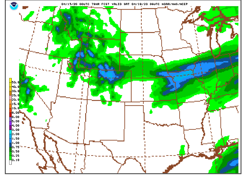
This indicated a bulls eye of 1.50 inch precipitation over the northern Front Range mountains and foothills which given a 15:1 snow ratio would produce 18 to 24 inch snow accumulations. Here is the observed snowfall from this storm:
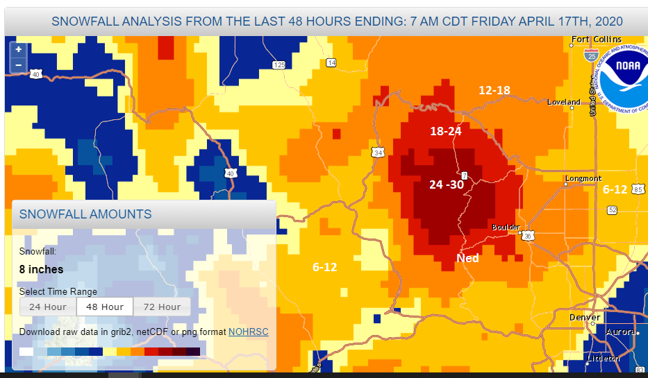
It turns out that the GFS forecast was pretty good. The Indian Peaks and much of central and western Boulder County were in the snow bullseye for this storm. I should note, too, that DarkSky was almost spot on with its forecasted snowfall as well. At one point on Tuesday they were calling for 21 inches in Nederland with a range of 18 to 27 inches. My forecast of 10-18 inches was obviously too low. When models are as divergent as they were in handling this storm and given the GFS’s tendency to go a bit overboard with precipitation, I couldn’t completely buy into its forecast. It is the job of the computer forecast models to provide possible outcomes to weather events. It is the job of the forecaster to cull through these data and try to come up with the best possible forecast.
Fun facts about this storm:
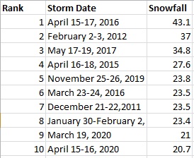
1) It was the tenth largest snow storm in the 10 years we have lived here:
2) Here are my measurements from this storm. I swept my snowboard every 8 hours:
Wednesday, April 15th, 11 PM: 2.9 inches of snow, 0.18 inches of liquid
Thursday, April 16th, 7 AM: 10.0 inches of snow, 0.73 inches of liquid
Thursday, April 16th 4 PM: 7.0 inches of snow, 0.52 inches of liquid
Thursday, April 16th 11 PM: 0.8 inches of snow, 0.04 inches of liquid
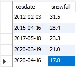
3) Thursday, April 16th, featured our 5th largest one day snowfall in my 10 years of records:
4) Notice that all of our largest April snowstorms have been from April 15th to April 18th. Coincidence? Probably, but interesting none the less:
5) For the season we are now at 177.8 inches, well above our seasonal normal of 153 inches
6) This is now our second snowiest season in my 10 years of records. The top season is 2015/2016 when we had 193 inches.
7) For the week, we have now had 35.2 inches of snow, which is about what we normally average for the entire month of April
8) This is the third 20+ inch snowfall this season. This has only happened once before in the 2015-2016 season.
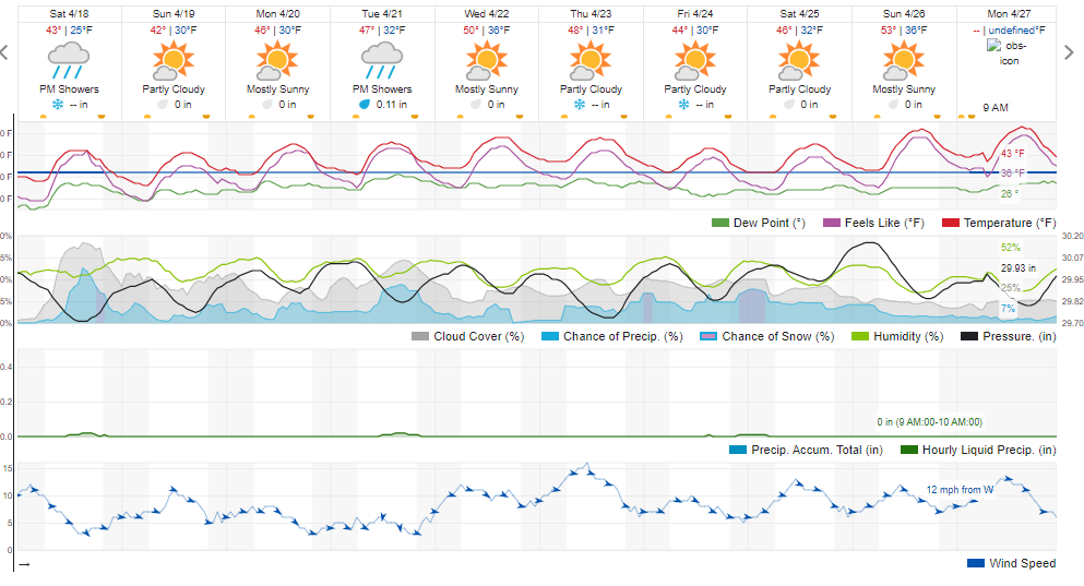
We will get a respite from the cold this weekend. Daytime temperatures should reach into the low 40s F both Saturday and Sunday. There will be a few snow and rain showers around the area on Saturday afternoon and evening, but little or no accumulation is expected. By next week, it will start feeling more like spring again with temperatures in the low 50s F by Wednesday. The nice thing about spring snow is that it usually melts in a matter of days. Here is the forecast from Weather Underground: