Our weather will be trending towards milder weather especially next week when a warm atmospheric ridge is expected to build over the Western United States. The latest 500 mb anamoly chart from the Weather Prediction Center tells the story:
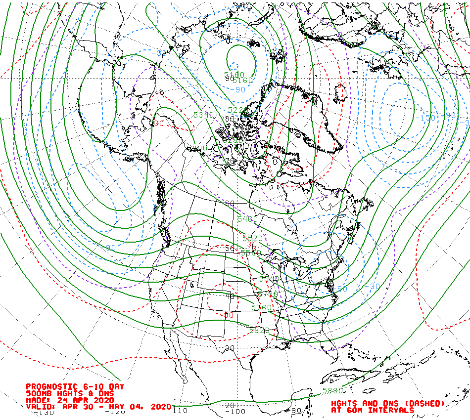
This chart shows a bulls eye of above normal 500 mb heights right over Colorado later next week into the first week of May. Higher heights usually correspond to warmer temperatures. Picture a column of air stretching vertically from the surface of the Earth to the mid levels of the atmosphere. The warmer this column of air, the more the air in this column expands and the higher it reaches up in to the atmosphere.
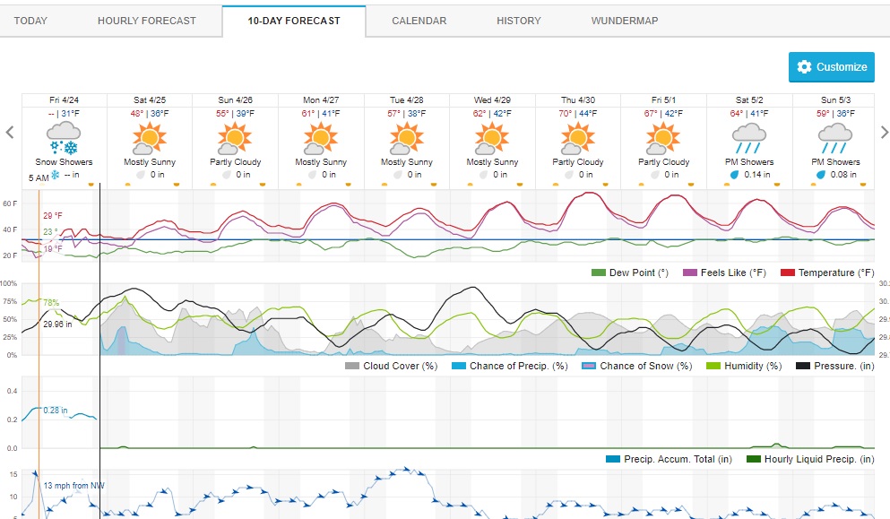
It is hard to believe that a little over a week ago we were in the grips of a significant spring storm. I only have a few inches of snow left here at our home in Nederland, and most of what remains should be gone by Monday or Tuesday. There are no big storms in sight, but we will be in northwest flow through this weekend, and little ripples of atmospheric energy will result in periods of snow showers in the mountains, and mix of rain and snow showers in the higher foothills. The Weather Underground forecast shows our trend toward milder weather. Yes, that is a 70F forecast for Thursday!
It has now been over a month since the vernal equinox. The sun has risen over the north pole where there is now 24 hours of daylight. Over the northern latitudes the increase in sun height and length in amount of daylight are translating to more insolation (incoming solar radiation). Cold airmasses which formed in the arctic and subarctic regions during the long nights of the polar winter are now dissipating. This means that our days will contiue to get warmer with only an occassional instrusion of cold air. The winters in Nederland are long, but it is almost May. We are slowly transitioning to the warm season here in the Southern Rockies.
Enjoy the weekend!