If you have lived in the Colorado Front Range, even for a short amount of time, you are no stranger to the topsy turvy, schizophrenic weather we experience, particularly in the winter. A January day can be warm enough for a round of golf – without a jacket. The very next day may feature snow and single digit temperatures. Folks living east of the Continental Divide are generally lucky in that cold snaps don’t normally last long. But when the temperature drops from 60 F one day to 15 F the next day, it can rattle even the hardiest of Coloradans.
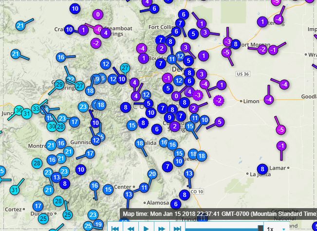
As of this writing, 10:30 PM Monday night, the temperature at our house at 8200 feet in the Front Range foothills near Nederland is -1 F. Yep, that is one below zero. A quick look at the plains down below shows temperatures in the 10 – 15 F range. As expected, a cold front pushed through northeastern Colorado on Monday morning, becoming entrenched east of the Continental Divide, but spilling over into high valley locations west of the Divide such as Winter Park. This map of current temperatures from Weather Underground shows the difference in temperatures across the state with sub zero values on the Eastern Plains and relative “balmy” temps in the 20s and 30s on the Western Slope:
As the front passed Monday morning, upslope flow commenced on the east side of the Divide. This combined with lift in the mid levels of the atmosphere due to a jet streak resulted in several hours of light snow. We measured 1.8 inches of snow here. As is often the case with arctic fronts in January, most of the snow fell between Boulder and Nederland. Weak upslope winds combined with a very cold airmass often results in the band of best snow (dendritic) crystal growth occurring in the lower elevations of the Front Range foothills.
As is the case with Colorado weather, the cold will be short lived. Daytime temperatures will rebound into the low to mid 40s (heat wave!) by mid week.
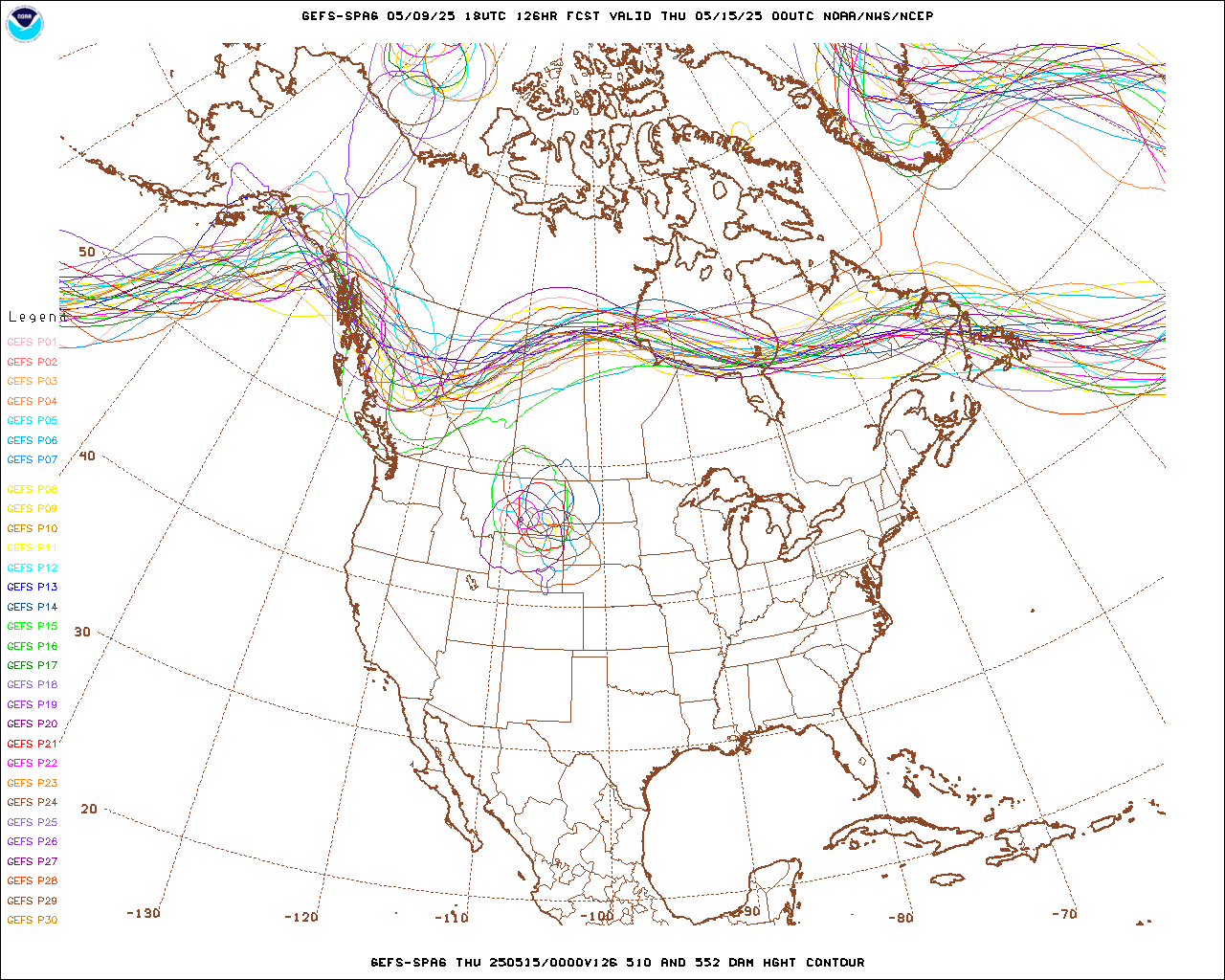
And then there is the upcoming weekend. Models have been hinting at the possibility of a more significant snowfall somewhere over Colorado Friday night through Saturday. There is alot of uncertainty, but more snow may be on the horizon for Nederland and the surrounding foothills communities. This is a ensemble plot from the GFS (American) model from midday today. These are also know as spaghetti plots, and you can see why. This one shows the various possible positions of the upper level storm track on Saturday, and as you can see, there is a good amount of uncertainty with the track of this next weather system. I have little confidence in 5 day forecasts, especially in Colorado. But wouldn’t it be nice to finally get a real snowfall? Meteorology is partly about conveying uncertainty, and I think we should wait a few more days before getting too excited.