Oh, the joys of weather forecasting on the Colorado Front Range! Every weather person likes to claim that his/her area is the hardest to forecast for, but I think that the Colorado Front Range takes top prize. The Rockies form a veritable wall of granite which stretches from northern New Mexico up into Wyoming, and these mountains can interact with the atmosphere in many different ways that makes weather prognostication, well, difficult.
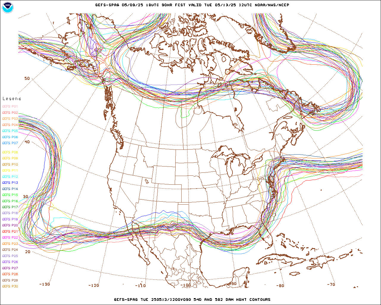
Ok, enough excuses, but this weekend’s storm will prove to be yet another forecasting challenge. All the models agree that a Pacific storm system will make landfall along the central California coast Friday evening and then carve out a trough of low pressure over the Great Basin by Saturday evening. From this point, the models are still differing on the exact track and speed of the storm as it sweeps across Colorado Saturday night and Sunday. The image below is an ensemble (spaghetti) plot from the 18Z GFS (American) model showing the possible positions of the storm on Sunday morning. There is a significant spread in possible storm locations ranging from on the Colorado New Mexico border to northern Colorado.
Remember that for significant Front Range foothill snowfalls, storms which track to our south are favorable. Storms which track to our north usually bring little precipitation, but more wind. The image below, also from the 18Z GFS, shows the spread in possible surface low positions on Sunday morning:
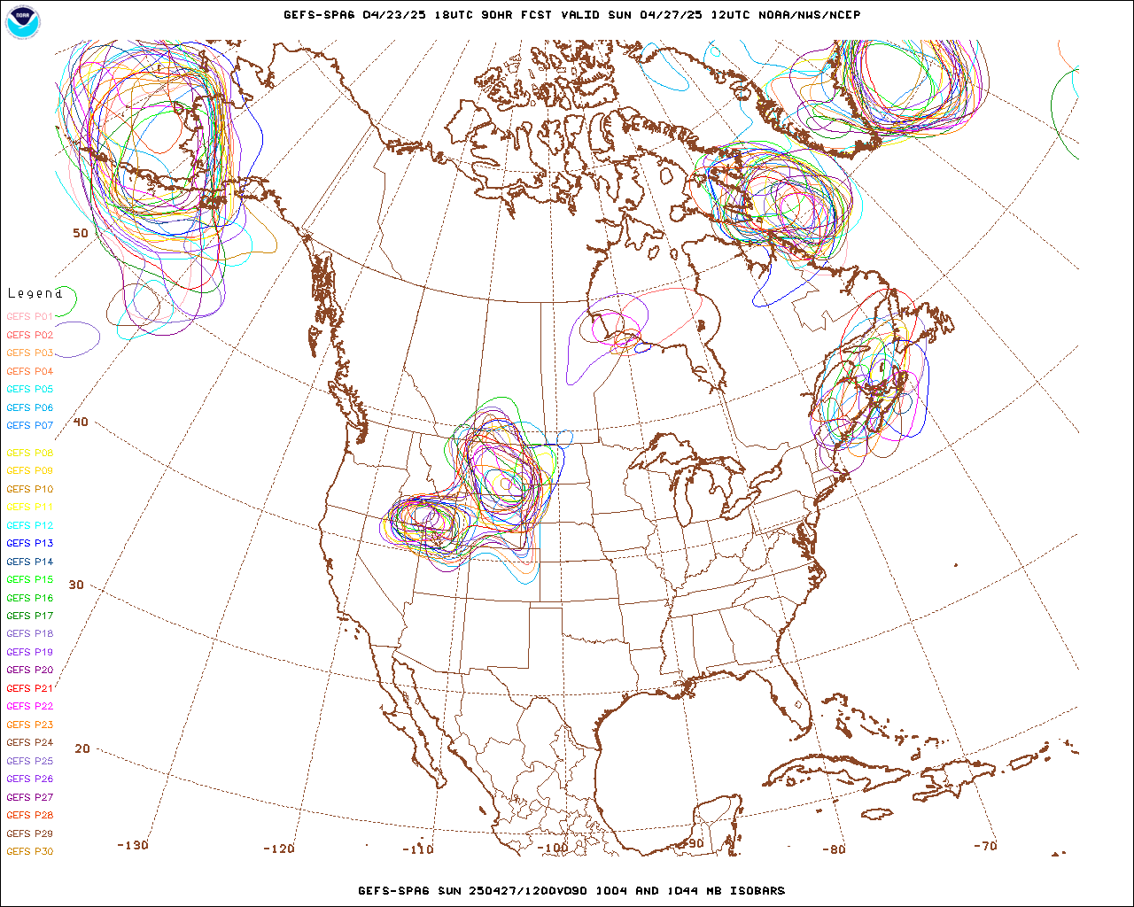
Again, there is a significant spread in possibilities.
The ECMWF model is slower and deeper than the GFS, with the storm further west and south Sunday morning:

It is probably a good time to review the Front Range Heavy Snow Checklist:
- An upper level low which tracks to our south – Maybe … as you can see above the models are still struggling with the storm’s track
- A slow moving storm system – No. This storm will be fast-moving with at most 12-15 hours of precipitation in and around Nederland
- An abundant supply of moisture – Well… Not really. It is January, and the Gulf of Mexico, the major source of moisture for Front Range storms is effectively closed for business. This storm has some moisture, but moisture becomes more abundant as we get into Spring. Also, fast moving storms do not have as much time to entrain moisture.
- Upper level energy – This depends on the storm’s track, but there is a decent amount of synoptic (widespread) lift
All in all, if this storm tracks to our south, I would expect a shot of light to at times moderate snowfall starting late Saturday night and ending my midday Sunday. It is too early for an accumulation forecast, but I would expect accumulations to be under 8 inches in Nederland and the surrounding foot hills communities.
Stay Tuned!