The observed precipitation map from the National Weather Service shows a decent amount of moisture across Colorado, particularly over the drought stricken southern parts of the state over the past seven days:
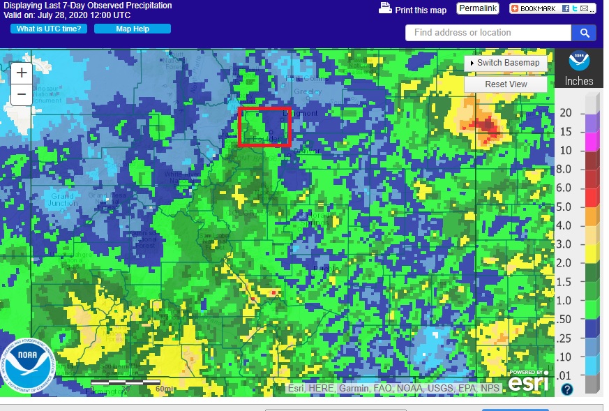
Boulder County is outlined in red, and it shows Nederland in the 0.50 inch to 1.0 inch range. While this is not a classic summer monsoon soaker, any precipitation is beneficial here in the Front Range Foothills, particularly during the summer. Today was a dissappointment. It was supposed to feature a really good chance of showers and thunderstorms as an upper level shortwave passed across the northern half of the state. However,strong westerly winds downsloped Nederland, leaving us high and dry with precipitation falling primarily in the lower Foothills and adjacent plains.
We will be in a stable weather pattern over the next several days with a ridge building over the desert southwest while a trough digs into the East. This will leave Colorado under a northwest flow regime. This will result in near normal temperatures (highs in the low to mid 70s with lows in the 45-50 F range). Nederland can get afternoon thunderstorms when the winds are blowing from the northwest, especially when pieces of upper level energy (vorticity maxes) are embedded in this flow. These storms normally do not produce a lot of rain, and rarely result in flooding problems. Here is a look at the winds at 500mb on Thursday:
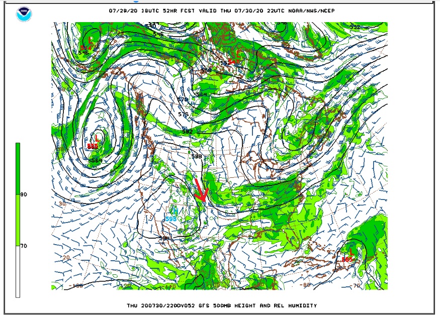
The red arrow shows the northwest flow over eastern Colorado.
Here is the Weather Underground forecast:
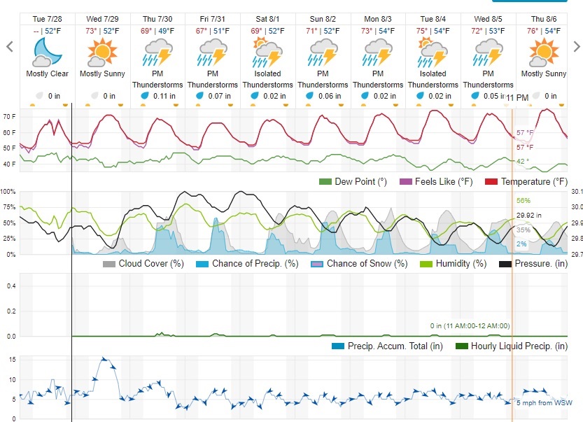
It is pretty much the usualy Colorado forecast with a chance of afternoon and evening thunderstorms almost each day.