The lastest 7 day precipitation forecast from the Weather Prediction Center pretty much says it all:
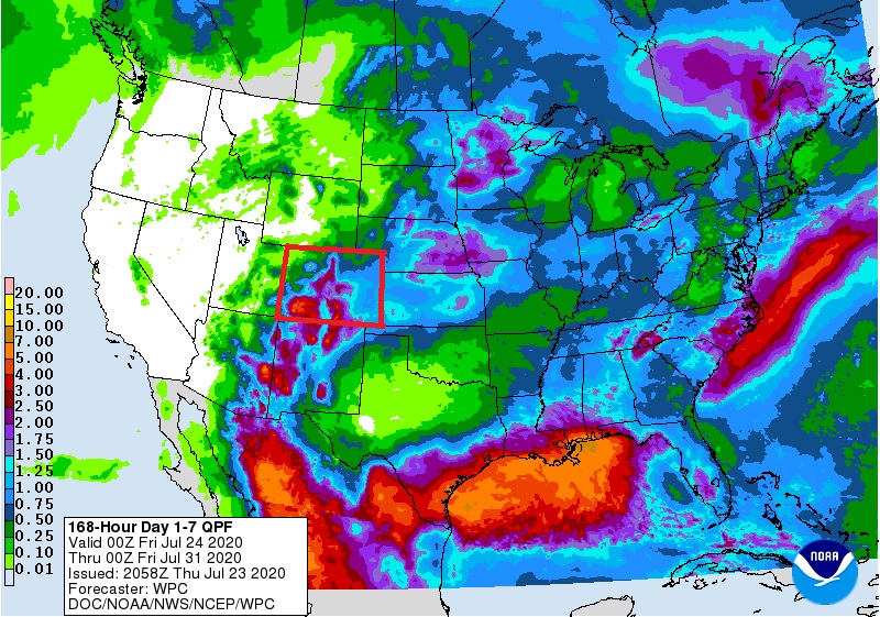
Colorado is outlined in red. This shows a healthy swath of Gulf of Mexico precipitation streaming northeastward across much of Colorado. This is what a monsoonal pattern looks like here in the Southern Rockies, and it is about time. We need rain in the Colorado Front Range. Things have become uncomfortably dry.
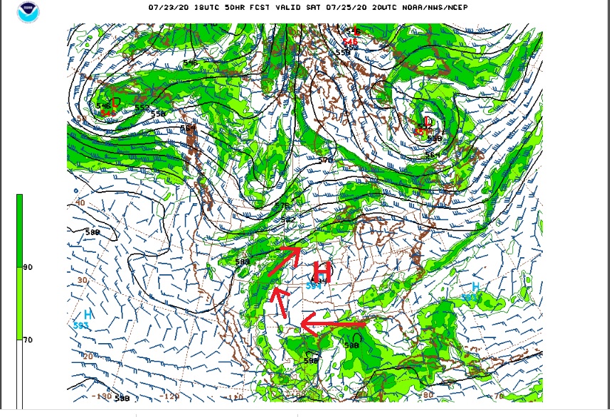
As advertised, a dome of high pressure will build over the Central Plains this weekend and remain there into early next week. The clockwise wind circulation around this high will help to pull moisture from the Gulf of Mexico back into the southern and central Rockies Friday into early next week. This moisture combined with daytime heating will result in widespread showers and thunderstorms during the afternoon and evening hours each day. Here is the 500 mb map on Saturday:
Overall, it looks like we will have a good chance of precipitation here in Nederland and the surrounding Foothills communities.
Here is the Weather Underground forecast:
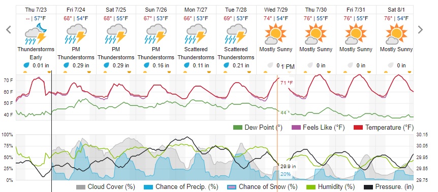
Note that not only is there a good chance of rain each day but also the temperaures will be comfortable. Not bad for late July.
In terms of its arrival date, the monsoon is a week or two late for the Foothills. It is a seasonal weather pattern here in the Rockies that does not always materialize. Here are my observations from the last several days:
Saturday, July 18: High 87 Low 59 Prepip 0
Sunday, July 19: High 83, Low 50 Precip 0.05
Monday, July 20: High 84 Low 56 Precip 0
Tuesday, July 21: High 77 Low 50 Precip 0.02
Wednesday: July 22 High 83 Low 47 Preip 0.06
Thursday: July 23 High 79 Low 54 Precip 0;01