This evening’s weather map shows a deep storm forming in the Northern Plains:
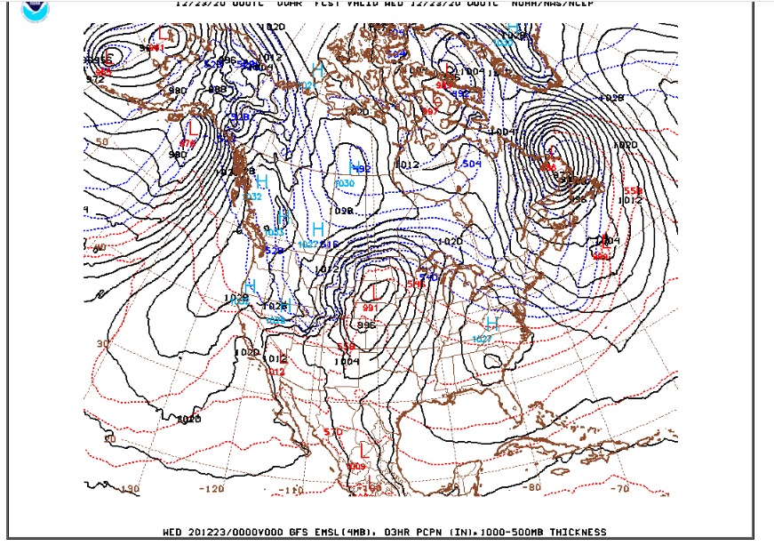
Northwesterly Bora winds behind this storm system are howling through Nederland tonight. There was even a period of snow this evening. It is hard to tell exactly how much snow fell, though, because the strong winds immediately whipped it up and blew it around. Temperatures will plummet tonight as much colder air wraps around this storm into the Rockies. By morning, it will be 5 – 10 F with wind chills near 0 F.
This storm will track into the Great Lakes Region tomorrow and Thursday pulling down colder air across much of the central and eastern portions of the country just in time for Christmas. As for us, it should stay cold enough to keep tonight’s snowfall around through Christmas. It will be a (barely) white Christmas for us.
The weather for the rest of the week looks decidely boring, like it has been for much of this year. Temperatures will moderate on Friday and Saturday before a reenforcing shot of cold air brings the chill back to Ned early next week.
Wednesday
Breezy and cold conditions will prevail. The sun will make an appearance, but temperatures will struggle to reach the mid teens F.
Thursday
Continued dry and warmer with highs near 30 F and overnight lows around 20 F.
Friday and Saturday
Both days will feature plenty of sunshine with highs in the low 40s F and lows 20-25 F.
Sunday
Colder air returns with highs in the upper 20s F and lows around 10 F.