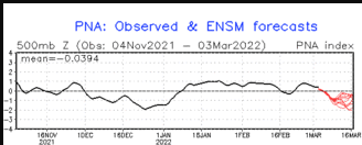
Much of December and the first week or so of January was highlighted by highly amplified flow in the mid and upper levels of the atmosphere and blocking. In this case, the jet stream and the associated storm track generally remained well to the north of Colorado, diving south eastward across the central United states, carving out a deep trough in the East. This meant the western United States experienced warmer and drier than normal conditions while the East was in the ice box with unusual snow falling in the southeastern states. This pattern was very stubborn to the dismay of western ski areas and snow sports enthusiasts. The Pacific North American (PNA) atmospheric oscillation is often the culprit behind these persistent periods of warm and cold weather. If you have watched enough weather updates, then you know that often when it is warm in the West, it is cold in the East. Conversely, when it is cold in the West, then it is warm in the East. The former case is know as a positive phase PNA while the latter is a negative phase PNA. The image below shows that the PNA has been predominantly positive since late November. Hence the below normal precipitation and above normal temperatures in the Colorado Front Range:
The weather pattern will become more progressive over the next few weeks. You know you are in a progressive weather pattern when cold weather alternates with warmer weather and storms become more frequent.
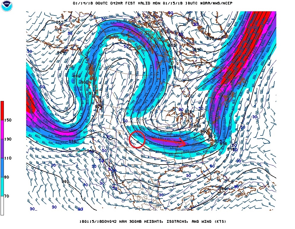
In the near term, the end of the weekend will feature dry and seasonable weather. A large area of cold high pressure will slowly sink southward into the northern plains states Sunday night, and this push much colder air into the Front Range late Sunday night and Monday morning. East/northeasterly upslope winds will push moisture up against the foothills resulting in a period of light snow east of the Continental Divide. Right now, it appears that this cold air mass and upslope winds will reach as high as 11000 feet meaning that most of the foothills communities such as Nederland, Ward, and Black Hawk, will experience a frigid, cloudy, and cold Monday. In addition to the lift produced by the upslope winds, there will be lift produced by a nearby jet streak – a core of faster winds in the jet stream (see below). This will help to augment snowfall in the foothills and along the plains. When all is said and done 1 to 3 inches of snow are possible in Nederland with the higher amounts of east of town.
Stay tuned … this will be a small storm, but it will make it feel like winter again!