Ready or not snow and cold are coming to Nederland. We have been talking about this storm for several days now and how consistent each of the forecast models has been with their solutions for this storm’s track and intensity. This evening, the NAM continues to produce between 1.0 and 1.5 inches of liquid precipitation for Nederland, Colorado and the surrounding Foothills communities. The difference is that now the GFS is more in line with the NAM, putting out nearly 1.0 inches of liquid precipitation. The descrepancies between the GFS and the NAM were one of the sticking points for me in this forecast. I still have some concerns as do others such as Weather5280 and OpenSnow, but in light of the latest weather data, I feel compelled to up my snowfall forecast a bit. Three days ago I started with 4 to 8 inches. I bumped this up to 6 to 10 inches last night. Tonight, I’m going with 8 to 14 inches with locally higher amounts of 18 inches or so possible, primarily to our north (where because of the they fires they really need it).
My concerns with this forecst revolve around several issues:
1) This is not a classic upslope storm for us. In fact, the upslope flow is not very deep on the east side of the Continental Divide.
2) This is a cold storm. Many times we do not get as much snow during cold storms or the snow ratios are lower because dendritic growth is limited at colder temperatures
3) The forcing for the precipitation is coming from a jet streak. This results in heavy snow bands. Snowfall totals can be hit or miss depending on whether you are or are not in one of these bands.
What is interesing about this storm is the that the sounding shows a good amount of warm, relatively moist air overrunning the cold air at the surface. Here is the NAM sounding:
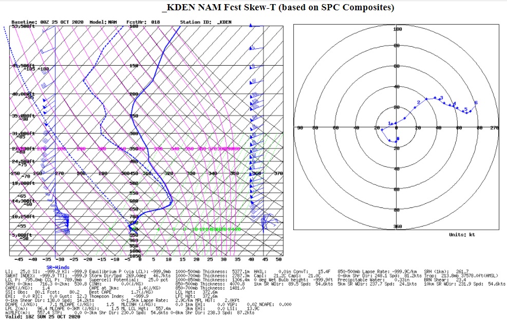
Notce that at 12-14 thousand feet, the temperatures are in the 20s F while here in Ned they are in the 5 to 10 F range. Given this profile, we could see some decent snowflake growth because of the warmer temperatures and saturated atmosphere above us.
Here is how I expect this storm to break down:
1) The cold air is already streaming into Nederland this evening. Overnight the air will saturate, and we will be in upslope fog. At first, I expect there to be some freezing drizzle. This will make for some tricky travel Sunday morning.
2) Sunday morning, the snow will start and will fall at moderate to heavy rates at times during the day
3) The snow should lighten up Sunday evening. Light snow will continue off and on into Monday morning.
Temperatures are the other big story with the storm. We may fall below 0 F Sunday night.
More than anything, we need the precipitation associated with this storm. Enjoy the snow! Be careful if you have to drive.