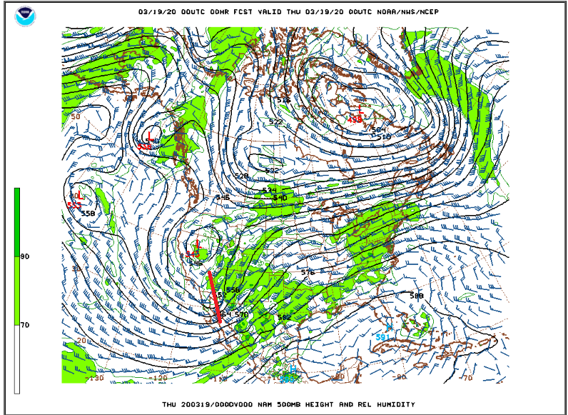
A potent storm system in the mid levels of the atmosphere will bring a return to cold and snowy weather to the Colorado Front Range Foothills on Thursday and Friday. As of Thursday evening, Nederland was already feeling the effects of this weather maker. After a mostly sunny day, the sky over the Indian Peaks quickly filled with clouds in the late afternoon, and there were even a few claps of thunder. This evening’s 500 mb weather map shows this upper level energy over the California, Arizona border:
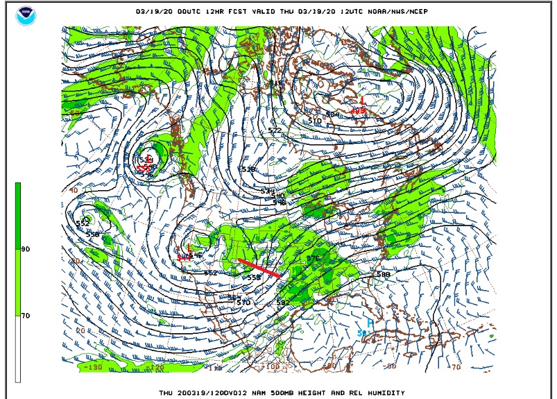
By Thursday morning this system is over southern Colorado:
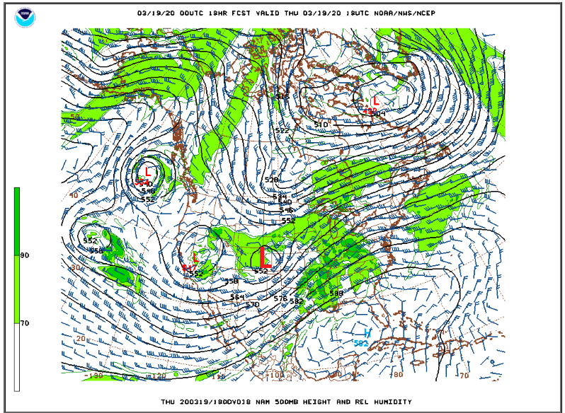
At this point the system is expected to start to close off and slow down. There is a considerable amount of energy with it(which you can see from the diffluence in the map above). By midday Thursday, The storm is centered over eastern Colorado:
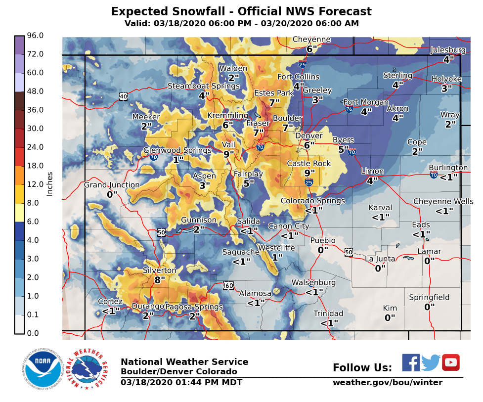
At the same time that the upper level low deepens and slows down, a surface cyclone will form over eastern Colorado. Northeasterly upslope winds behind this storm system will help to push and lift moisture up along the Front Range Foothills. This combined with the dynamics associated with the upper level low will result in periods of heavy snow, perhaps 1-2 inches per hour. By the time all is said and done early Friday morning, The National Weather Service is calling for 8 to 14 inches of snow in Nederland and the surrounding Foothills communities:
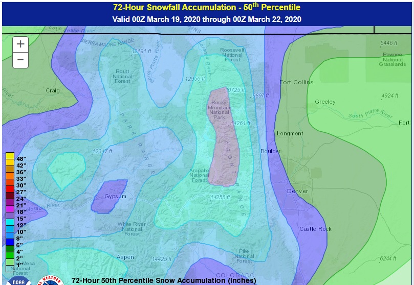
The 50th percentile snowfall forecast from the Weather Prediction Center (WPC) concurs with this:
This will likely be a high impact event for us with both the morning and evening commutes being icy. The recent warm weather means that the initial snowfall will melt on contact on roadways and then freeze as temperatures drop and the snow intensity increases. If you are already hunkered down due to Covid-19, then enjoy the snow. Otherwise, be safe on the roads!