Not much has changed in the forecast intensity of this weekend’s snowstorm. The current water vapor loop shows the center of this storm spinning just off the southern California Coast:
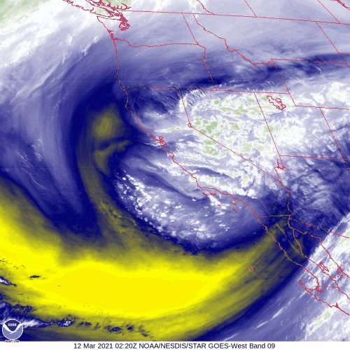
Over the next 30 hours, this storm system will move to a position near the Four Corners region. Then it will slowly move eastward along the Colorado/New Mexico border. By Sunday, this storm will be spinning over southeastern Colorado .
As this system approaches Colorado it will begin to entrain Gulf of Mexico moisture adding to the moisture that it is already pulling in from the Pacific Ocean. The slow motion of this low across southern Colorado Saturday and Sunday will prolong upslope flow across Northern Colorado, and this will augment precipitation amounts. In addition to this, a trough of warm air aloft (also known as a TROWAL) may provide a direct feed of moisture from the Gulf of Mexico into Northern Colorado. There is even the possibility of thunder snow on Saturday when the dynamics associated with this low reach us.
Forecast snowfall totals for Nederland are all high end at the moment:
DarkSky: 40 inches
Weather Underground: 33 inches
National Weather Service: 24 – 48 inches
Colorado Open Snow: 30 – 60 inches
Denver 7 Weather: 24 – 48 inches, locally up to 60 inches
Wow!
And here is the NWS forecast snowfall map:
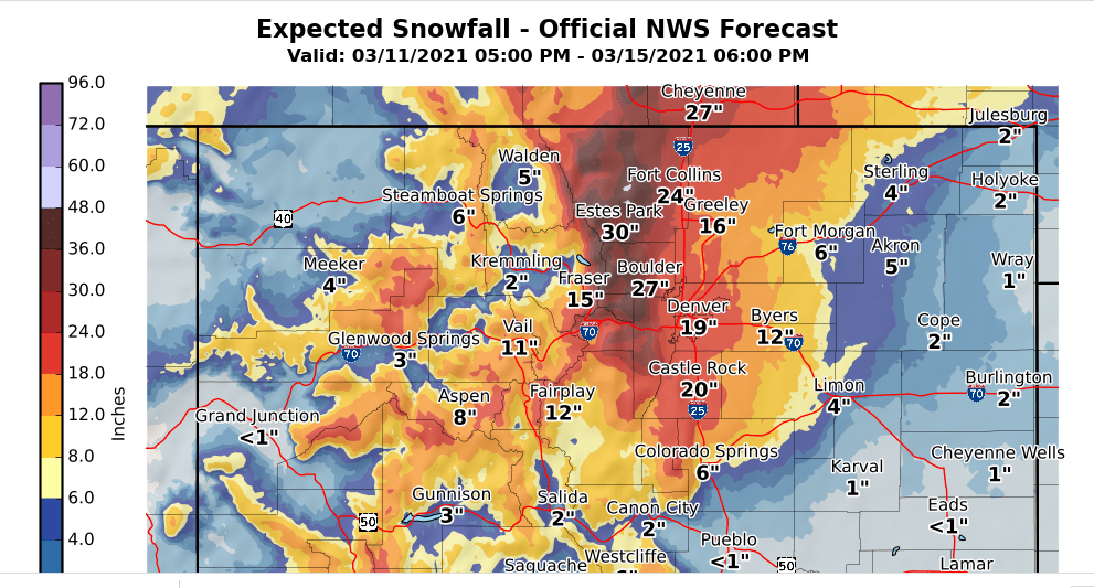
Yes, that is 27 inches for Boulder, and 19 inches for Denver.
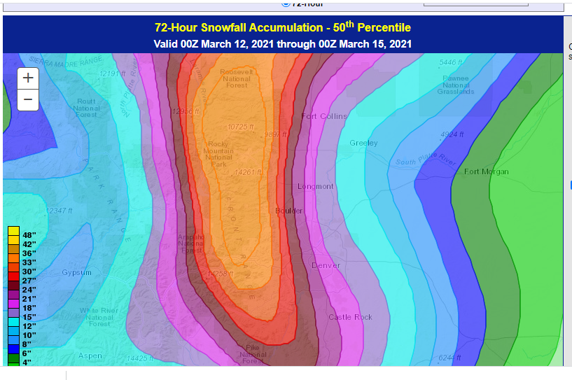
The Weather Prediction Center’s 50th percentile snowfall forecast for us through Sunday evening is 36 inches. The 75th percentile forecast is 48 inches:
Note that the storm has slowed down a bit as well, meaning the heavier snow probably will not start until later Saturday morning, and it will likely continue into Sunday evening.
As I have been reading in other forecaster’s blogs, everyone is trying to find ways in which this storm will not happen or not be as strong. A forecaster is naturally skeptical, especially when you are talking about accumulations such as these. As long as the storm keeps a more southern track and moves slowly, we will get a lot of precipitation.
Snow ratios are another issue. With temperatures around 20-25 F for the bulk of the event and warmer air advecting over us aloft, ratios may be 12:1 or even 10:1, making this a wetter snow than what we are used to. Wetter snows have higher impacts on roadways and they weigh more, putting strains on branches and roofs.
Needless to say, if this storm pans out the way it is appearing, then travel will be very difficult if not impossible on Saturday and Sunday. This will be a high impact event. You may be stuck in your house for a few days.
Stay tuned. I’m still having a hard time believing this…