Take a moment to visit Weather5280’s site (www.weather5280.com). They do an amazing job analyzing and forecasting Denver’s weather. This evening they did a comparison of the precipitation and snowfall forecasts from many different models and ensemble products. The good news is that the models, particularly the NAM, are starting to come more in line with the expected strength and track of this weekend’s storm. Even this morning, there were some significant differences between the models which were resulting in a large amount of uncertainty in our snowfall forecast. Large upper level cutoff lows can be very difficult to forecast, and even small changes in track and speed can make a large difference in the weather we get here in Ned.
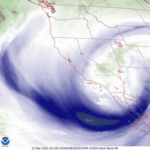
And what about our storm? It is current spinning away in the mid and upper levels of the atmosphere over northwestern Arizona:
This storm will move to near the Four Corners region by Saturday evening and then slowly track eastward along the Colorado/New Mexico border Satuday night. On Sunday this storm will slowly wobble eastward over southeastern Colorado. This slow motion will mean a prolonged period of upslope precipitation for us in the northern Front Range Foothills.
As this storm approaches, it will drawn in a large amount of Gulf of Mexico moisture. East/southeasterly winds are already pulling in oisture this evening. This nighttime microphysics satellite image of the Central Rockies shows a solid deck of low level stratus (the green clouds) piled up east of the Continental Divide:
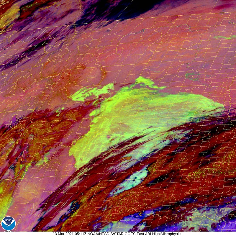
The darker clouds are high clouds that are streaming out ahead of the storm.
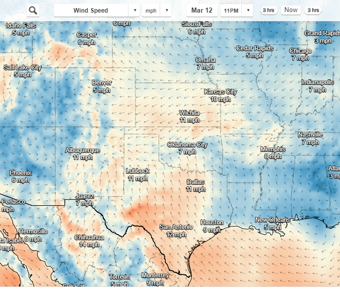
And the latest DarkSky surface map shows the winds predominantly from the east to southeast on the plains:
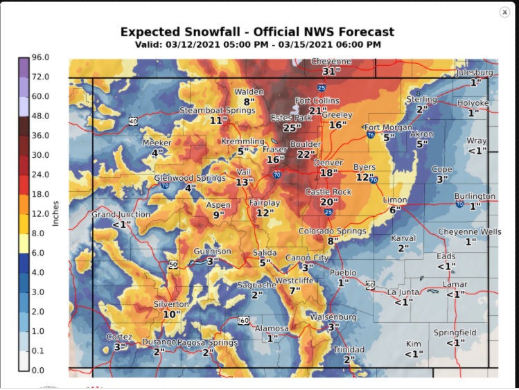
Not much has really changed with the snowfall forecast for Nederland and the northern Front Range Foothills. The general consensus is that we will see somewhere between 24 to 48 inches of snow by the time the storm winds down Sunday night. The heaviest totals will likely be in the Foothills between Nederland and the Wyoming border. A few locations, particularly in Larimer County, may see 5 feet of snow.
Here is the NWS most probable snowfall forecast map:
This system has slowed down somewhat over the past few days. It now appears that the heaviest snow will start around midday Saturday and continue into Sunday evening. The winter storm warning for Nederland starts at midnight and continues until 6 AM Monday morning.
This will be a relatively warm storm, and I think snow ratios will be around 12:1. This will be a denser heavier snow than we are used to. Take it easy if you are shoveling. From a practical point of view, the impacts on area roads will likely be high. Plan on not being able to go anywhere from Saturday night through much of Sunday, and perhaps into Monday. There is also a decent chance of losing power for a day or two. Be prepared for the worst.
There are always surprises with these types of storms. We’ll see what happens over the next few days. Be safe out there!