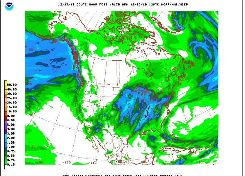
Well, it is not really THAT cold, but there will be a chill in the air the next few days, and there may even be a little bit of snow on Friday night and Saturday. Weather forecasting is complicated business. For the past several days we have been watching a southern tracking upper level low, and this system is still expected to result in cyclogenisis in the southern Rockies on Friday night. The tricky part of the forecast is determining the exact track of this low as it intensifies and sweeps northeastward across western Kansas and Central Nebraska Saturday and Saturday night. Up until a few days ago, it appeared as if all of the precipitation associated with this storm would stay well to our east. Then, yesterday the GFS model started hinting at significant snow accumulations over northeastern Colorado, especially east of I-25. Now, the GFS is somewhat less bullish with the precipitation forecast. Here are the latest and greatest 00Z NAM and GFS precipitation amounts for Colorado. The GFS says:
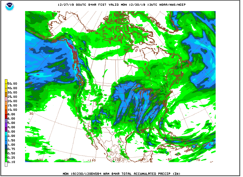
While the NAM says:
In general, it now appears that this storm will not become very organized or strong until it has passed to our north and east. I still think that we will see a period of light snow Friday night into Saturday morning, but now the models seem to be indicating liquid amounts of 0.10 to 0.25 inches here in the Front Range Foothills, which given a 1:15 snow ratio would translate to 2 or 3 inches of new snow. Here is another way of looking at a weather event. It is a time height plot which shows the winds and moisture in the atmosphere from the ground up to the tropopause over the next several days. You read it from left to right. Remember, we live at about 750 mb (the red line):
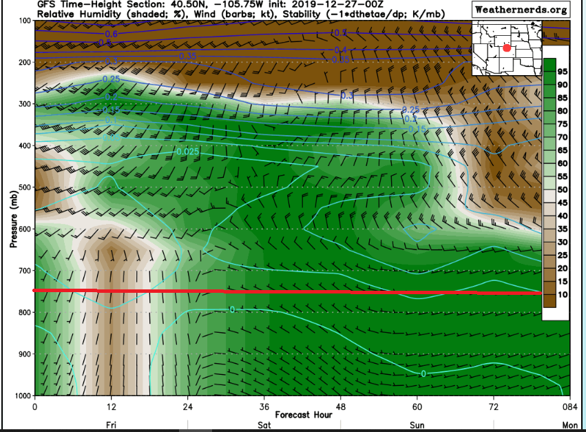
This shows a good amount of moisture working into our area Friday night and Saturday. Winds, however, are not optimal for us, generally from the northwest. This is by no means a big storm for us. Maybe more important than the couple of inches of snow we will likely see here in Nederland will be the cold temperatures on Saturday and Sunday (highs 15-20 F) with lows in the 5-10 F range.
The Weather Underground forecast pretty much says it all:
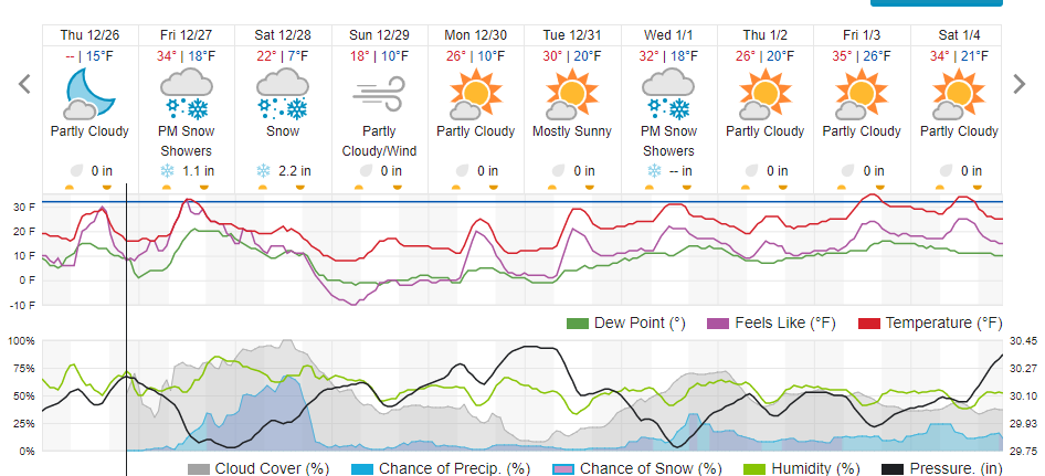
It will be breezy around Nederland and the Indian Peaks on Sunday as the storm intensifies and pulls away to our northeast. Model soundings are showing winds up to 40 kts with much higher gusts, and it will be an uncomfortable day to say the least if you are headed up into the Front Range Mountains. These winds should begin to let up by Monday. There are no big storms in sight, at least for Nederland. As I mentioned before, this is typical for January. Can you believe it is almost 2020? Time flies when you are having fun!