The Tuesday evening 500 mb weather map shows the two storms we have been talking about now for several days: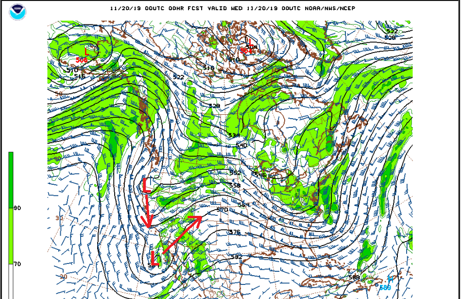
The closed low which has been spinning off of the coast of Baja California has begun the process of opening up and ejecting to the northeast towards Colorado. Meanwhile the strong shortwave trough in the Pacific Northwest is digging southward down the West coast. Both of these systems will be affecting our weather starting on Wednesday and continuing into Friday.
A cold front will pass through Nederland and the surrounding Foothills communities Wednesday morning, and as it does winds will turn from the north-northeast. At about the same time, energy from the ejecting low will be passing over Colorado. The combination of this cold, moist upslope flow and the upper level dynamics and lift from this low will result in a period of snow starting Wednesday afternoon and continuing into Wednesday evening. By Wednesday evening most of the energy associated with this first low will be past us and the second low will establish itself over southern California:
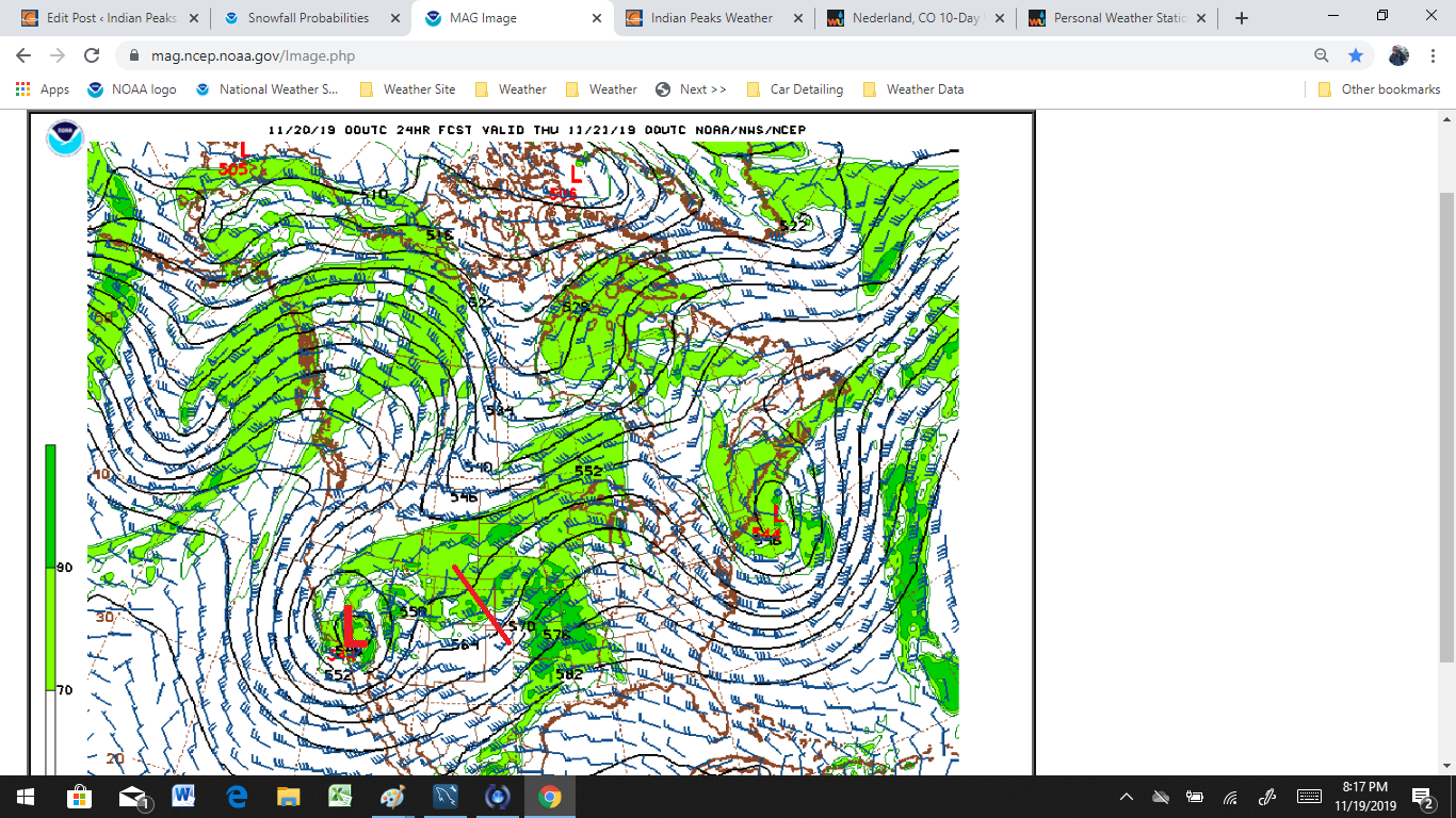
This second low is the big question mark in this forecast. It’s exact track and strength will determine how much snow we get in the second phase of this storm on Thursday and Thursday night. The latest NAM is keeping this low intact as it slowly heads towards Utah and the Four Corner region:
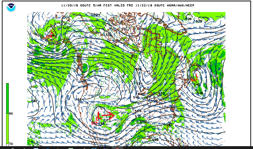
The latest NAM is also being very bullish with precipitation in the northern Front Range Mountains with 1.0 + inch liquid precipitation amounts over the Indian Peaks:
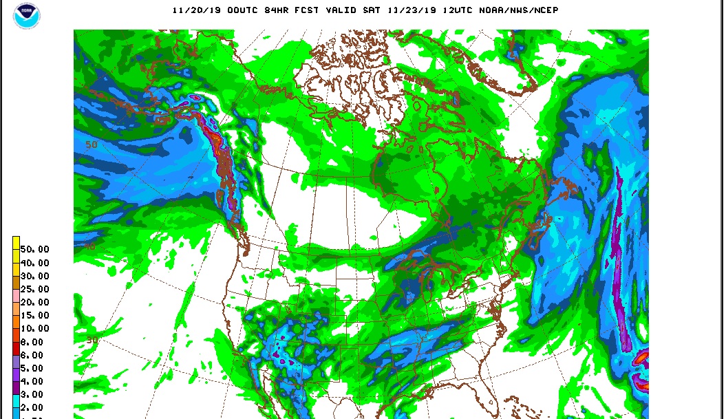
Okay. Take a deep breath. Breath… It is easy for weather enthusiasts, particularly snow-lovers to get caught up in the data. One problem here is that the GFS model is not nearly aggressive with the precipitation amounts. Also, these types of systems, particularly cut-off lows, are very difficult to forecast. This is especially true in a scenario like this where the lows are interacting with each other. I’m not trying to make excuses here, but there is a lot of bust potential in this forecast, especially for the Front Range Foothills.
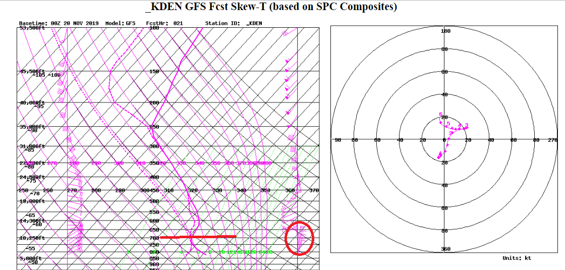
Also, looking at the atmospheric cross-sections and Skew-Ts, the mid and upper level winds are not really optimal for upslope snow in the Foothills east of the Continental Divide. On the NAM, these winds are disorganized. On the GFS, at least Wednesday evening, there is shallow upslope, maybe up to 11000 feet:
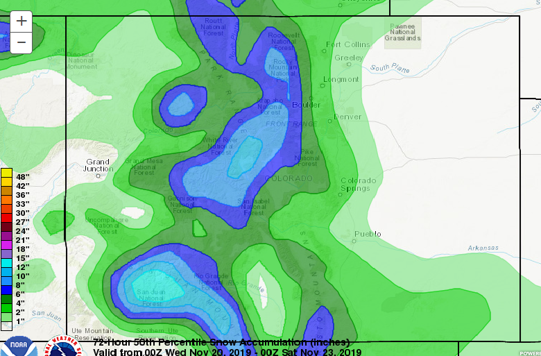
Looking around at forecast total snowfall amounts for BOTH systems through Friday, the Weather Prediction Center’s 50th percentile forecast looks to be about the consensus, producing 6 to 8 inches in Nederland, Rollinsville, Ward, and Black Hawk:
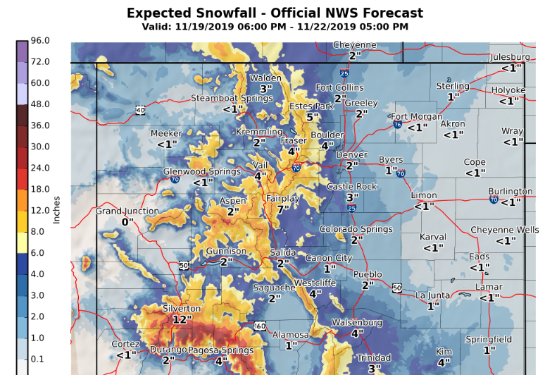
The Boulder National Weather Service’s Forecast is similar:
In short, for Nederland,
- Temperatures will turn colder Wednesday afternoon with mainly light snow developing in the afternoon
- This snow will continue into Wednesday evening before diminishing. Accumulations will be in the 2 to 4 inch range.
- After a bit of a lull in the snow Thursday morning, it should redevelop with another 2 to 4 inches possible by Friday morning
- Temperatures will remain below freezing all day on Thursday
- Winds should be light from the northeast during most of the event.
I think the west facing slopes of the Indian Peaks will do well during this storm with 12+ inches of snow likely. The San Juan mountains in southwestern Colorado will do the best with up to 24 inches possible in some places.
Stay tuned! This is a fun and complicated storm system. In many ways, it is not an optimal snow even for Ned, but it does have a good amount of moisture and snow energy. There will likely be a few surprises with the snowfall forecast!