Winter weather will return to the Colorado Front Range Foothills and adjacent plains on Wednesday afternoon and evening. A short wave trough over the Pacific Northwest this evening will dive into the Four Corners Region by Wednesday evening. A cold front associated with this system will sag southward across northern Colorado on Wednesday, and a chilly, moist upslope wind regime will become established in Nederland during the afternoon. The fog will roll in during this time as temperatures drop back into the teens F.
This system has many similarities to the storm that brought us accumulating snow last week. This is a cold storm system with upslope flow up to 10,000 feet. The moisture is also deep. If anything, the upper level (or synoptic) lift is slightly weaker this time around, but temperatures will be conducive of good snowflake growth and high liquid to snow ratios.
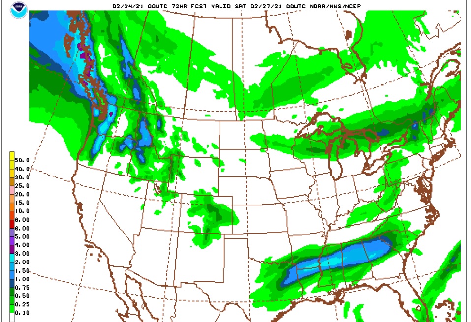
The latest model guidance is producing between 0.25 and 0.50 inches of liquid here in Ned. The GFS places the bullseye of 0.50 inch plus totals just to our south:
A 20 to 1 snow ratio would result in 5 to 10 inches in Nederland and points south in the Front Range Foothills. The NAM is less generous with the precipitation painting a broad swatch of 0.25 liquid amounts.
Much like the last storm, the highest snow totals will be in the lower Foothills east of Nederland. The National Weather Service nicely captures this in their snowfall forecast:

So how much snow will we get? Here is what the various source are saying:
National Weather Service: 4 to 8 inches (for our forecast grid point 4 miles east of Ned)
DarkSky: 7 inches
WeatherUnderground: 5.5 inches
Weather Prediction Center: 4 to 6 inches
Denver 7 News: 6 to 10 inches
AccuWeather: 6 to 12 inches
Given that the heaviest snow totals could very well fall south and east of us, I like the National Weather Service’s forecast of 4 to 8 inches. Either way, this will be more much needed moisture for our parched forests. We still have a long way to go to dig out of the severe drought we are in, but every little bit helps!
Beyond that, temperatures should remain below freezing into this weekend with more snow possible on Friday night and Saturday.