A deep storm system which has been pummeling California with feet of snow in the Sierra and inches of rain along the coast is headed our way. As I mentioned in my last post, the big impact with this storm will be wind not snow for Nederland and the surrounding Front Range Foothills communities. As the upper-level storm approaches us from the west later tonight and tomorrow morning, a surface low will form over northeastern Colorado and rapidly intensify. By midday Wednesday, a very tight pressure gradient will set up over the northern Front Range mountains. This tight pressure gradient will accelerate and energize the winds in our area:

The National Weather Service has issued a high wind warning for all of eastern Colorado including the Front Range Foothills. For Nederland, the forecast is calling for west winds 30 to 50 mph with gusts to 60 to 80 mph and a few locations seeing gusts up to 100 mph! The latest NAM -based Skew-T and hodograph show 50 to 60 knot winds around Nederland for a good part of the day. This translates to 60 to 70 mph with higher gusts:

There will also be snow with this storm system, but that will mainly be confined to the higher elevations of the Front Range Mountains. Nederland will be getting downsloped for a majority of this storm by the strong and gusty westerly winds. While we may see a few snow showers, accumulations will be light, and what does reach the ground will blow away. Up in the Indian Peaks around Brainard Lake and northward towards Rocky Mountain National Park, 3 to 7 inches may fall.
This storm will quickly exit to the east Wednesday night, and as it does the winds will diminish. In the wake of this storm, temperatures will be more seasonable for this time of year with highs in the 30s F and lows in the upper teens to mid 20 F. Friday will be the coldest day with highs only in the 20s F.
There is still no sign of significant snow through the end of this month. The GFS total precipitation map through December 30th shows no precipitation for Eastern Colorado and the nearby Plains states:
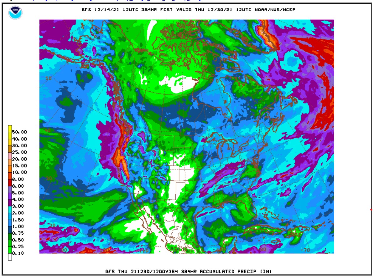
It looks like the mountains of western Colorado will see some snow, which is great for the ski areas, but we are high and dry here in Ned. Bad news if you are dreaming of a white Christmas.