Here is the latest Colorado snow pack map from the NRCS:
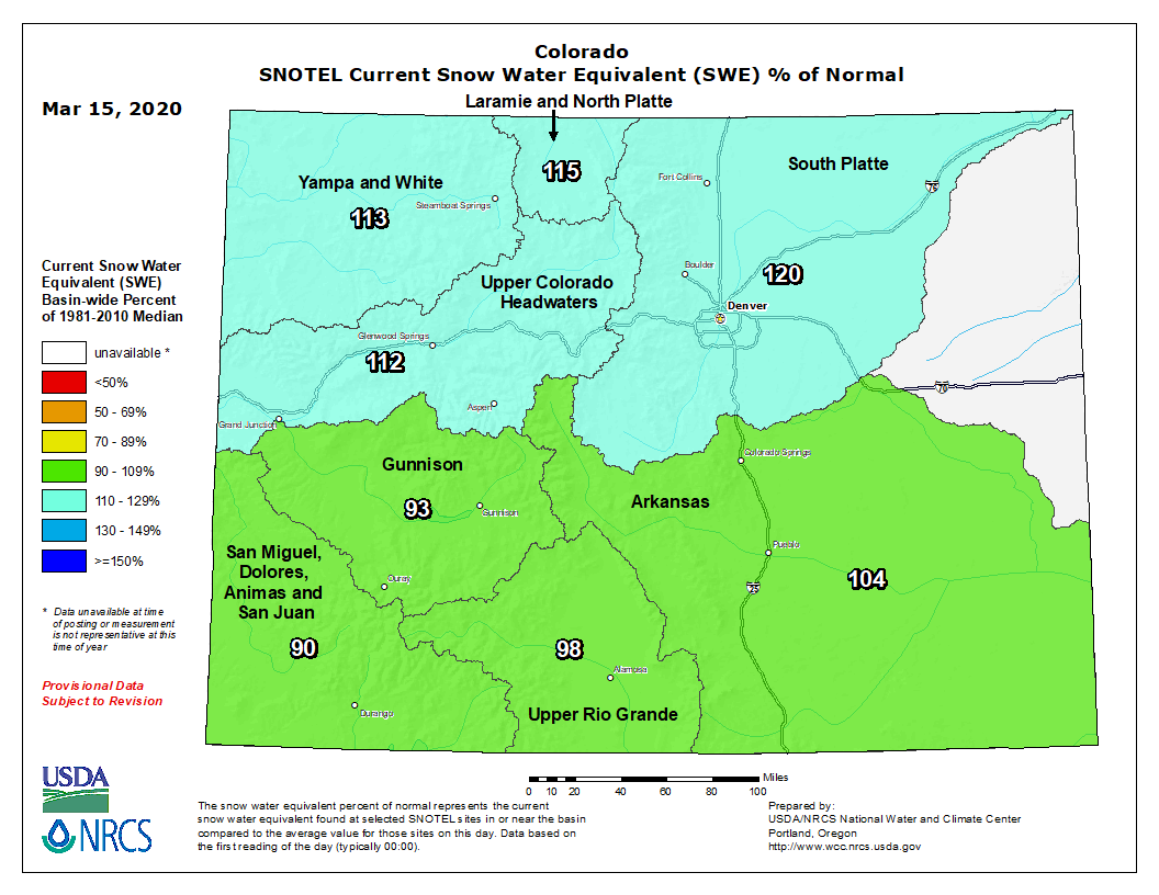
This map still shows the South Platte river basin, the one in which Nederland resides, at about 120% of normal snow pack. Here is a look at the Niwot Ridge SNOTEL station’s data:
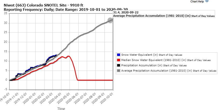
This shows the eastern flank of the Indian Peaks about 3 inches above the median snow water equivalent for this date. Overall, from a hydrology perspective, things are looking pretty good in northeastern Colorado. Even though the southern and southwestern portions of the state are just below normal, they are still in moderate to severe drought according to the Nation Drought Monitor:
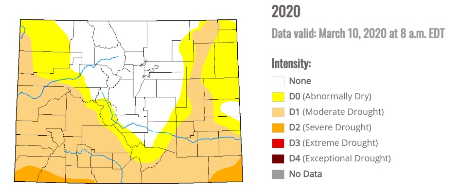
It takes a long time and persistent and frequent precipitation events to eradicate drought.
The first few days of this week will be mild and dry with above normal temperatures. A storm system is expected to bring snow to the Front Range Foothills communities Wednesday night and Thursday. The details of this storm are far from clear, but here is the forecast from Weather Underground:
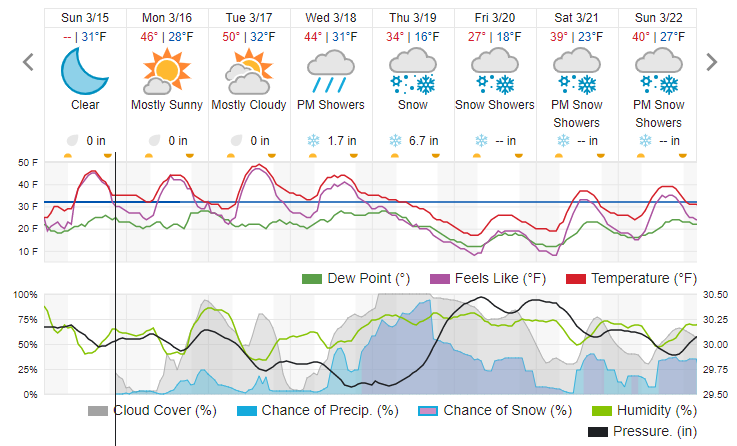
I’ll have more details about this storm later. For now,enjoy the dry and warm weather Monday, Tuesday, and Wednesday.