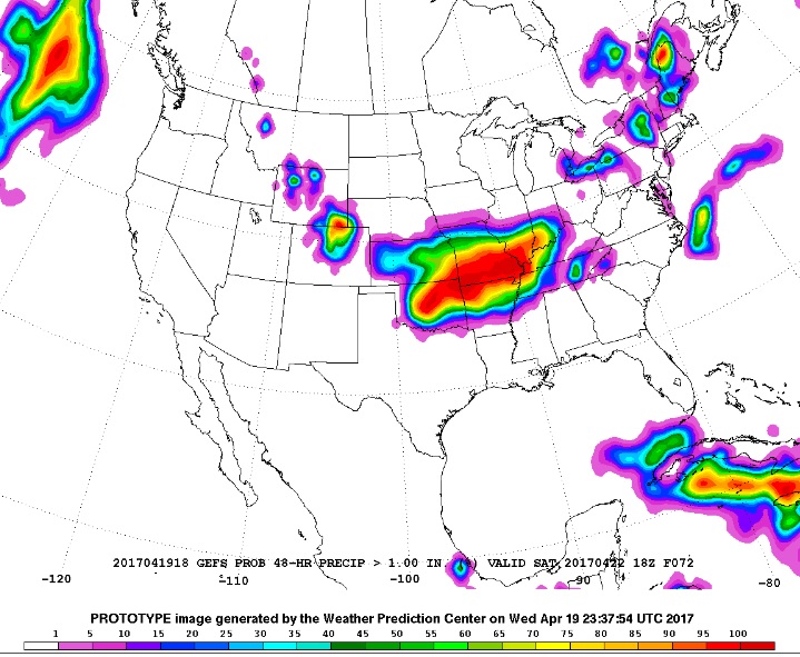
After a few weeks with virtually no precipitation, rain and snow will return to Nederland, the Front Range foothills, and the Northeastern Plains Thursday night and Friday. The weather forecast models continue to show anywhere from 0.50 to 1.25 inches of liquid precipitation along the northern Front Range Thursday night and Friday. This image shows the probability of total precipitation greater than 1 inch from midday Thursday through midday Saturday. Notice the bulls eye over northern Colorado and along the Colorado/Wyoming border. This is the area of the greatest likelihood of high precipitation totals, and this area includes Nederland.
Temperature and snow level will be the determining factor as to what type of precipitation falls in Nederland and how much snow we get. Thursday evening, snow levels will still be relatively high, somewhere between 8500 – 9000 feet. However, the snow levels will gradually lower Thursday night, and likely be somewhere between 6500 – 7000 feet by Friday morning, with some sources saying it will be closer to 6000 feet. That said, rain will develop Thursday and likely change over to snow after midnight. Snow will continue through Friday morning as temperatures drop into the upper 20s. The ground is warm, and this will initially limit snow accumulations. However, by Friday morning, Ned should be covered in a heavy wet blank of spring snow. By the time the storm winds down Friday afternoon, 4-8 inches of snow will have fallen, with some spots seeing up to 12 inches, depending on elevation. Stay tuned for updates!