A slow moving storm system is setting its sights on on the Central Rockies for the later part of this week. Models have come into better agreement that a deep low in the upper levels of the atmosphere will slowly dig into the Great Basin Wednesday and Wednesday night and then slowly push eastward across Utah and Colorado Thursday and Friday.
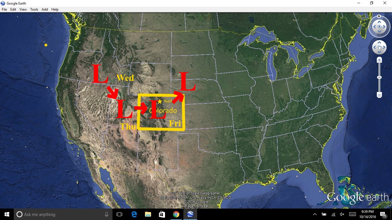
There are several ingredients coming together which point to the possibility of a significant precipitation event in Nederland and the surrounding Foothills communities starting Wednesday night and continuing through Friday. In particular:
- This is a very slow moving storm. Slow moving storms mean a prolonged period or rain/snow resulting in higher precipitation accumulations.
- The forecast track of the storm takes it across central Colorado which spells a prolonged period of upslope flow along the east side of the Front Range mountains
- This storm has significant upper level dynamics and lift which could help to enhance precipitation production
- This storm will pull in an ample supply of moisture
- There is plenty of cold air, and a majority of the precipitation should fall as snow. Snow is even possible on the Eastern Plains Thursday night and Friday.
All that said, the start of this storm is still 24 hours away and as we have seen many times this season, these storms can be very fickle. A shift in the storm’s track or speed will make or break this forecast. At the moment, it looks like:
- Rain will start Wednesday evening an turn to snow by 11 PM
- Snow will continue through Friday. That does not mean it will snow heavily the entire time. Also, it is May. The sun angle is high and the ground is warm. Although temperatures should be below freezing (brrrrr) for much of the storm, the warm ground will initially slow accumulations and some melting could occur during the day when snow intensities let up.
- The National Weather Service has a Winter Storm Watch up for Nederland and the Foothills communities between 6000-9000 feet with forecast accumulations of 1-2 feet (yes FEET) with locally up to 3 feet possible. This will be a heavy, wet snow. That combined with trees with leaves will likely result in broken tree limbs and power outages. Roads will start off wet and then becoming slushy and icy.
Stayed tuned. This has the potential to be a significant, high impact event here in Ned.