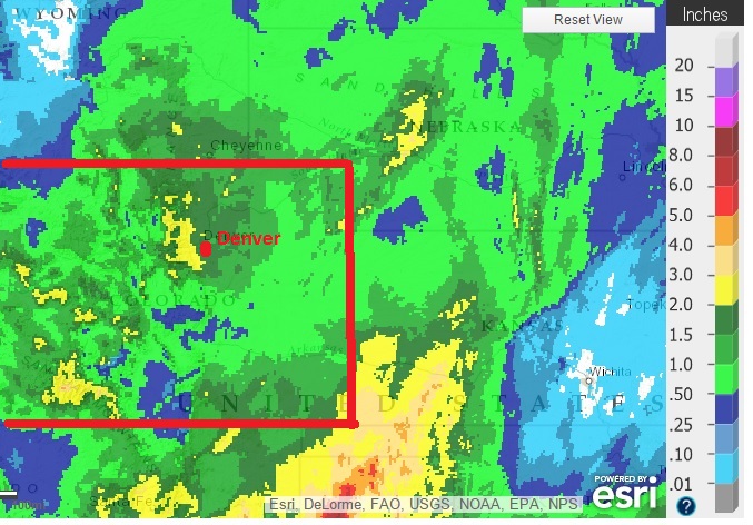
The deep upper level storm system which produced copious amounts of precipitation east of the Divide in Colorado has exited the Central Rocky mountains. 1 to 2 inch precipitation totals were common in Northeastern Colorado, with some of the highest amounts in the foothills west of Denver.
If this has been snow … yes, if this HAD been snow … totals would have exceeded 2 ft in some foothill locations. As it was, this was a warm storm. Snow levels did briefly drop to 8000 feet on Thursday, but for the balance of the storm snow levels hovered between 9500 – 10000 feet. We took a quick drive to the Caribou townsite above Nederland, which is at an elevation close to 10000 feet. There was 8 inches of heavy wet snow on the ground.
The jet stream lifts to our north over the next few days as the upper level flow becomes more zonal. This pattern often results in more seasonable temperatures and weak, quick-moving storm systems. Nederland will have plenty of opportunity to dry out into early next week. A weak cold front will nudge into Northeastern Colorado Monday night. This will help to lower temperatures a few degrees, but there is not much precipitation evident. This has been the wettest October in the 5 years we have lived here, ringing in at 2.17 inches so far this month.