A piece of energy in the upper levels of the atmosphere, also know as a short wave, will brush Northern Colorado Tuesday night into Wednesday morning bringing light snow. The winds will remain predominantly from the northwest resulting in the best chances of snow along and west of the Continental Divide. Despite this, a few snow showers will make it into the Front Range Foothills, but accumulations will be light.

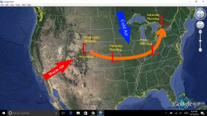
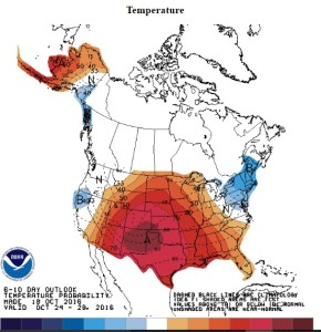
After a brief cool down, warmer temperatures will return for the latter half of the week. The storm system over Northern Colorado Wednesday morning will track eastward to a position over Eastern Kansas Thursday morning and Southern Ohio by Friday morning before intensifying over the Eastern Great Lakes this weekend. As the storm exits to the east, unseasonably mild conditions will return to Nederland and much of Colorado. For snow lovers, the 6-10 day outlook looks bleak – warm and dry – not good weather for snow, but great for hiking in the Flat Irons and biking in Boulder.
Long range forecast models are still hinting at more winter-like conditions later this month into early November. We’ll see…
