As of this writing (10:00 PM Saturday night) colder air is advecting into the Front Range Mountains and Foothills, and temperatures have already dropped back into the upper 40s F. Upper 30s F are expected by Sunday morning. A second and stronger cold front will sag southward across Northern Colorado Sunday afternoon. As the this front passes through, the winds will swing around from the north and temperatures will plummet back into the 30s F. Monday morning’s lows will be in the 25 to 30 F range. There is not much in the way of moisture with either of these two fronts, but there could be a few rain and snow showers around Sunday evening. The big news is the cooler temperatures. Sunday’s high temperatures will likely be early in the morning.
The cool weather will continue through Monday before a slight warm up on Wednesday.
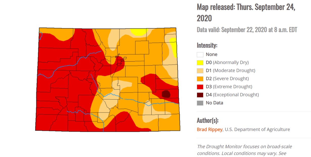
With the winds becoming more northerly over the next few days, we will likely see more smoke from the Cameron Peak fire as well as from the new Mullen Fire in southern Wyoming. There is not much in the way of precipitation expected over the next week, and our continued lack of precipitation is exasperating our drought conditions here in Colorado:
This is about as dry as I have seen it in the 11 years we have lived here. Also, La Nina winters do not tend to be drought busters. We could be in drought at least into next spring.
Enjoy the cooler weather and check out the Aspen! Despite our early freeze, the colors are looking pretty good!