Although Nederland and the northern foothills communities are technically only a few inches of snow behind normal for this time of year, much of the southern half of Colorado is much drier with snowpack values ranging anywhere from 50 to 70 percent below normal, as can be seen in this latest Colorado snowpack map from the NRCS:

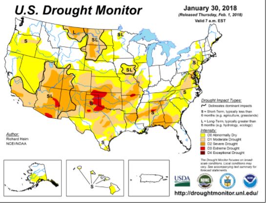
This is reflected in the Climate Prediction Center’s drought monitor which shows all of Colorado and much of the southwestern United States as experiencing some degree of drought:
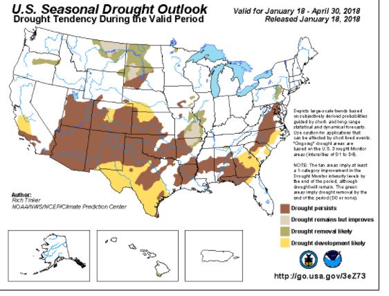
The seasonal drought outlook is bleak:
A ridge of high pressure which has been anchored over the western United States for the past few months has effectively pushed the storm track to the north and east of Colorado. The northern Front Range has been lucky enough to catch some precipitation from a few passing storm systems, but further to our southwest in locations such as Durango, little precipitation has fallen and much drier than normal conditions are persisting.
This pattern will hold in place at least through this next week. A storm system may pass close enough to Nederland and the surrounding Front Range Foothills communities Monday night and early Tuesday to bring a brief shot of light snow and cold, but milder temperatures will return my mid week. Our snowy time of year normally starts in the late winter and continues into the spring. That said, a strong La Nina combined with a very persistent western US ridge could spell the start of a dry spring and a potentially devastating fire season.