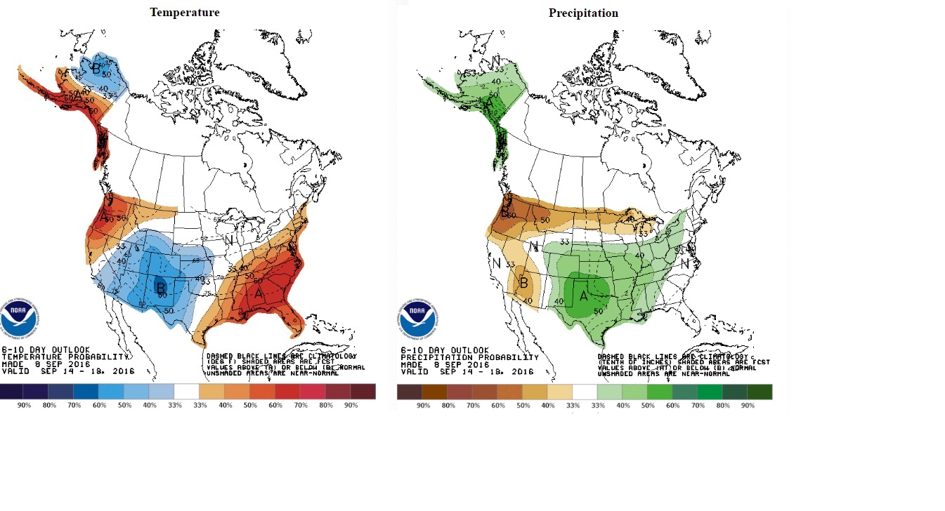
A cold front will push across the Northeast Plains of Colorado midday Friday. This will be followed by a noticeable drop in temperatures and winds blowing from the east up Boulder Canyon into Nederland. Although there will be some cloudiness in the afternoon hours, little or no precipitation is expected. As the sky clears Friday night, temperatures will plummet into the low to mid 30s. This will result in frost, and in some locations along North, Middle, and South Boulder Creeks temperatures may reach 32 F, really close to a freeze. The cooler temperatures will be short lived. This brief tease of fall-like weather will be followed by warm, sunny, and dry weather on Saturday and Sunday, a great weekend for outdoor activities! By Monday and Tuesday of next week a cooler and wetter pattern will settle into the Front Range Foothills. The Climate Prediction Center’s 6-10 day outlook shows below normal temperatures and above normal precipitation through the balance of next week. In fact, snow levels may drop down to 10000 feet Monday night into Tuesday. Significant accumulations are not expected, but it will be enough to whiten the tops of the Indian Peaks.