After a tranquil Thanksgiving Day in the Colorado Front Range Foothills, another storm system will affect our weather on Friday into Saturday. This time, our main concern will be wind, not snow. In fact, by Saturday morning, model soundings are showing 40 – 60 mph winds in Nederland and the surrounding Foothills communities. Here is a look at the GFS upper air sounding and hodograph for Saturday morning. This sounding is for Denver, and Nederland is about 1 km above Denver. I’ve circled the winds at 1 km on the hodograph as well as between 750 mb (8200 ft) and 650 mb (13500 ft) on the sounding:
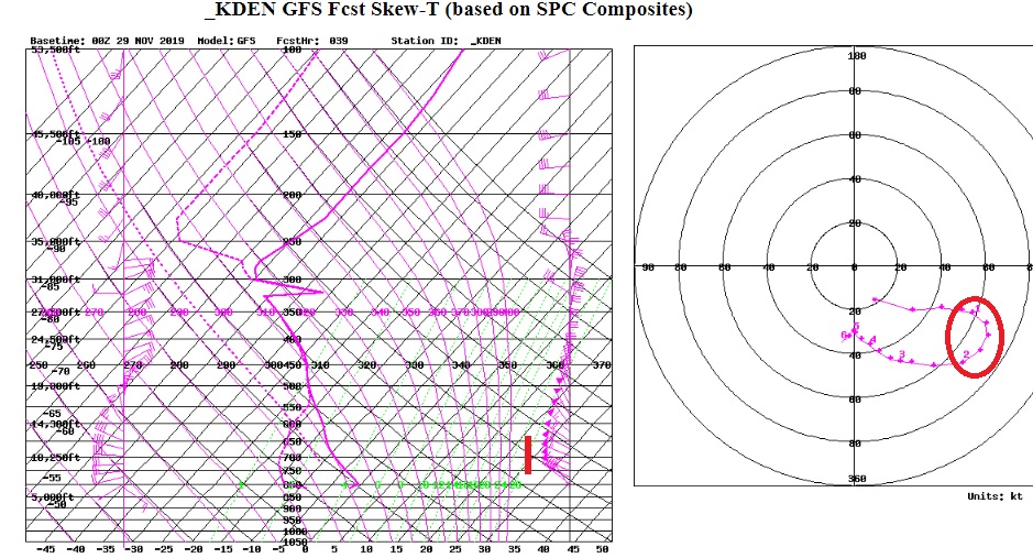
This shows winds gusting up to 65 kts on Saturday morning which translates to 74 mph! If this forecast is correct, then I would expect there to be some damage to trees around Nederland, Rollinsville, and Ward. Needless to say, Saturday will not be a good day to venture into the higher elevations of the Indian Peaks, particularly above tree line.
A storm system over eastern Utah on Friday morning will track into northwestern Colorado by midday before redeveloping over the Colorado Eastern Plains on Friday afternoon. This transfer of energy, also known as lee side cyclogenesis, will bring the chance of a few light snow showers Friday evening. As the plains storm deepens and moves to the northeast towards the Nebraska Panhandle, the tight pressure gradient behind this storm will produce strong and gusty winds over northeastern Colorado Friday night and Saturday morning. By Saturday morning, this 984 mb low will be over the Nebraska Panhandle:
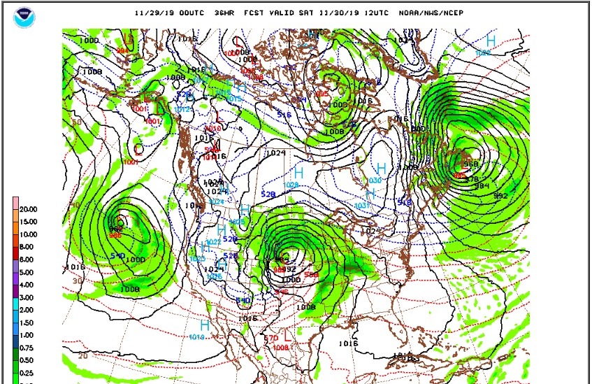
As this storm slowly pulls away from the Southern Rockies on Saturday and Sunday, winds will diminish. By Sunday, temperatures should be moderating with plenty of sunshine.
If you have any loose objects outside around the house such as lawn furniture, BBQ grills, or small pets, you may want to bring them in the house or garage on Saturday morning, or they may end up in the next county.