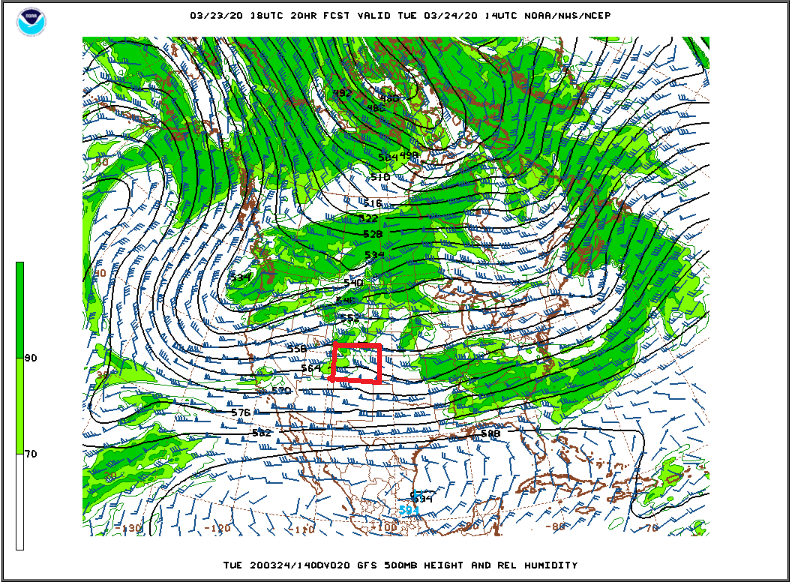
Tuesday, Wednesday, and Thursday will bring a pleasant reminder that it is really spring here in the Colorado Front Range Foothills. The 500mb height, wind, and relative humidity map shows weak ridging over the southern and central Rockies on Tuesday morning (in case you are wondering, the red square is Colorado):
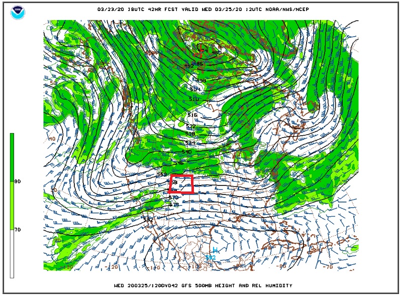
This continues through Wednesday morning:
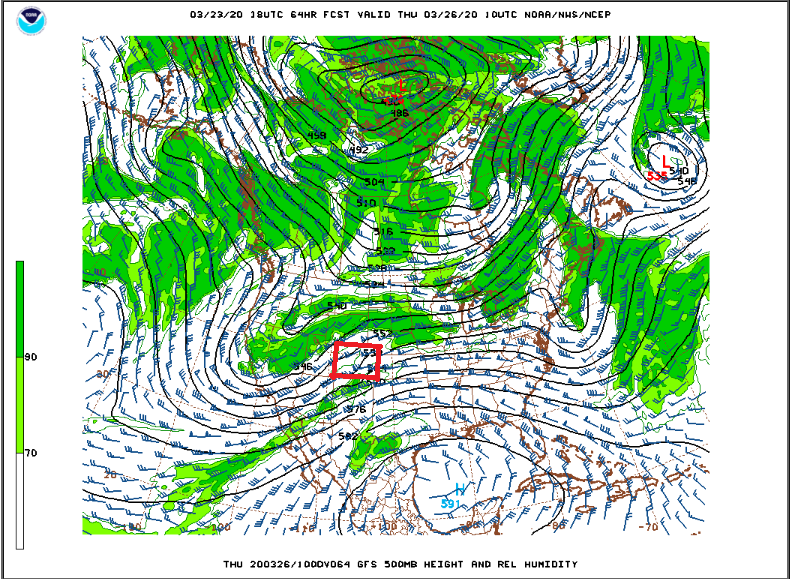
And into Thursday morning:
By Friday, the trough which has been hanging off of the West Coast will push into the Central Rockies. This will likely bring a return to unsettled and cooler weather by Friday. At the moment, the GFS is showing this system cutting off over Central Colorado by midday Friday:
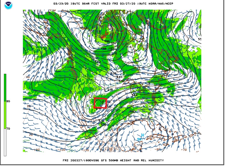
This system is still a ways out, and it does not appear to be nearly as strong as last Thursday’s storm system. Still, it could be an opportunity to up our seasonal snow total, get some back country skiing in, and boost the water supply for the coming warm season.
If you are heading out in to the Indian Peaks over the next few days expect it to be windy (20-40 mph gusts to 50 mph), but it should be dry.
Here is the Weather Underground forecast for Nederland:
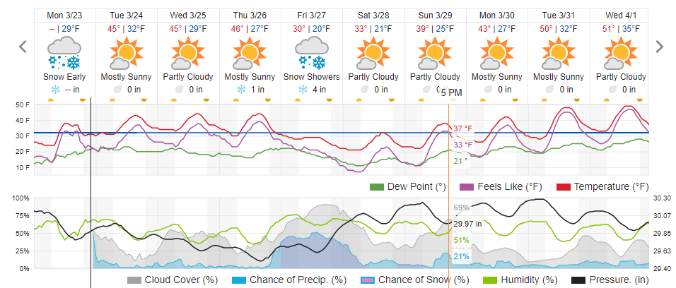
Highs in the mid 40s F the next few days will feel good! Enjoy!