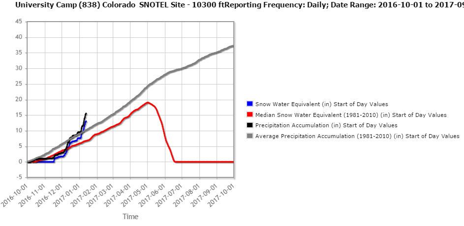
Nederland’s streak of winter-like weather will continue over the next several days. A persistent pattern of moisture-laden pacific storms has brought the mountains of Colorado copious amounts of snow over the past few weeks, and even Nederland and the surrounding Front Range foothills communities now have a respectable amount of snow on the ground. After a slow start to the 2016-2017 winter season, snow pack in and along the Continental Divide in Northern Colorado is well above average at many locations. The chart below shows the precipitation and snow water equivalent totals at University Camp, which is located just north of Nederland near Rainbow Lakes. The snow water equivalent (blue line) is at least 7 inches above normal. The actual snow depth at University Camp is around 55 inches. Most stations in the Indian Peaks up into Rocky Mountain National Park are reporting snow packs of 175 – 210 percent of normal. This is good news for water supply and the local forests, especially given that last year was much drier than normal here.
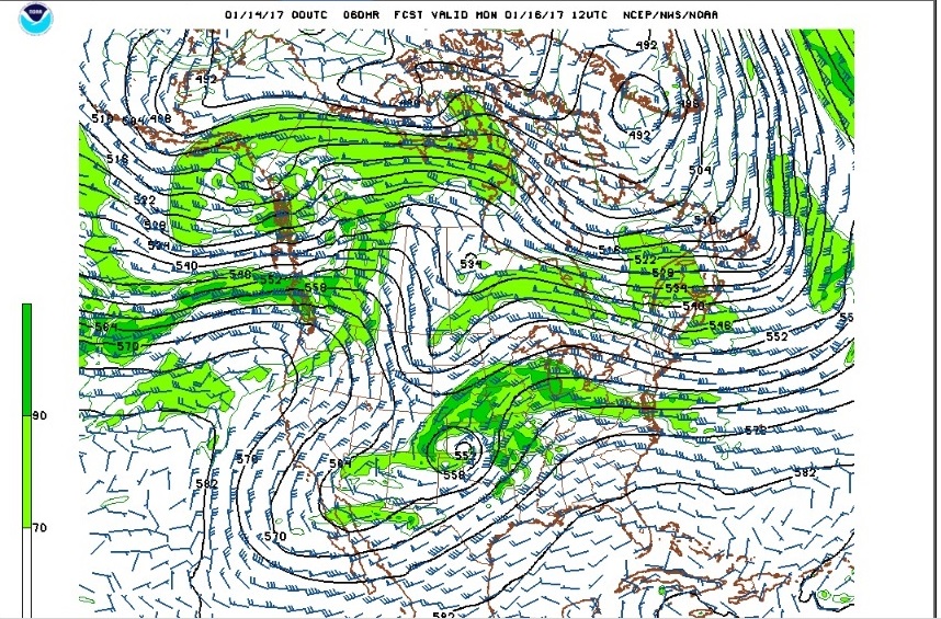
A storm system currently spinning off of the the Southern California coast will be the next potential weather maker here in Colorado. By Saturday morning, this storm will be crossing the Baja California Peninsula and tracking to a position just south of the Arizona New Mexico border by Sunday morning. From there, this storm is expected to lift northeastward toward the Colorado/Kansas border by Monday morning. The exact details of this storm’s track are still very uncertain, and a shift of one hundred miles to the west or east can make the difference between little or no precipitation and several inches of snow.
The forecast models have been inconsistent in handling this storm’s track. Right now, it appears that snow will spread from south to north across northeastern Colorado starting Sunday afternoon and continuing into Monday morning. I’ll post updates over the next few days. Enjoy the tranquil start to the weekend and expect at least some winter weather by Sunday night.