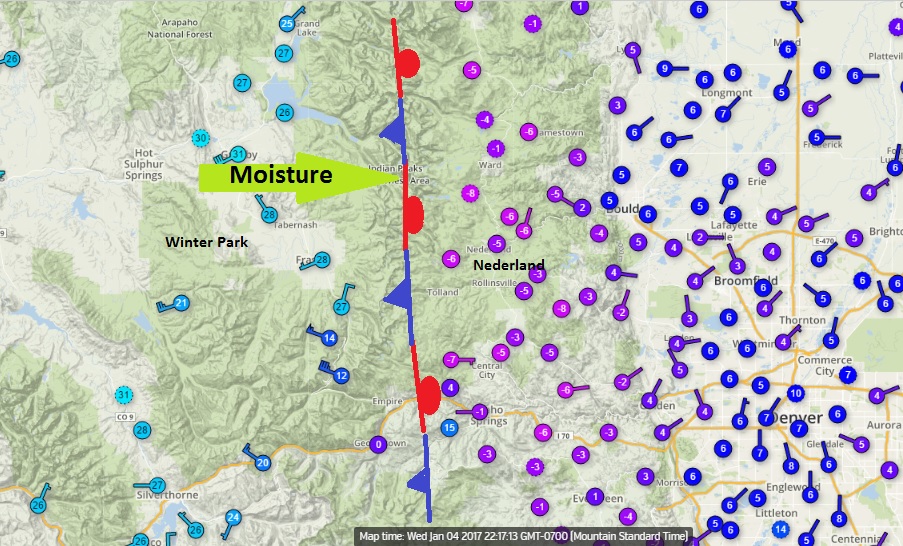
Snow continues to fall across the Colorado Front Range this evening as a combination of a strong arctic cold front, a stream of bountiful moisture from the Pacific Ocean, and a strong jet stream create bands of heavy snowfall across northeastern Colorado. Many locations in the foothills have already received 8-10 inches of dry, fluffy snow as of this writing, and snow will continue through the night. What is more phenomenal are the temperatures. It is -6 F here in Nederland at 10:30 PM. Just 12 miles across the Continental Divide, it is 28 F in Winter Park and Fraser. The boundary between relatively warm air and bitter cold has set up right along the Continental Divide. Ordinarily, Fraser is in the ice box, but tonight it is much colder east of the Divide. Moisture from the west is streaming up and over the cold air entrenched over us, and this is resulting in snow. Not too far above us, the temperatures are warm enough for good snow dendrite (flake) growth.
Look for a tricky commute tomorrow morning with snowfall totals in some locations exceeding 12 inches. Powder Day!