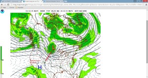
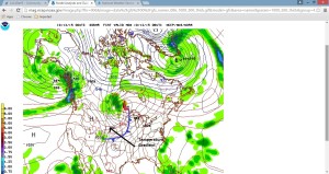
Those who have lived a few years in Nederland know how fierce the winds blowing down from the Continental Divide can be. They also realize that these winds tend to be more of cool season phenomenon, with some of the windiest days occurring from mid October through April. Tonight, after a relatively tranquil summer, the winds have returned to Nederland. So far, the highest gust has only been 40 mph (we’ve measured up to 90 mph in other years), but when the roof starts to creak and groan and our westward-facing windows begin to noticeably flex, we know we are being visited by a fabled Chinook or Bora wind, two forms of what are known as a barrier winds. These winds are often accelerated by pressure and temperature boundaries in the atmosphere. Tonight it is both … a tight pressure gradient has set up over northern Colorado as a deep mid atmosphere low pressure system passes to our north. Also, a cold front associated with this storm is slowly approaching us from the northeast … a so-called back door cold front.


As far as Nederland wind storms go, this one will not be epic. As the cold front sags southward over Colorado’s Eastern Plains and backs up against the Front Range mountains, the winds will gradually become more easterly, putting an end to tonight’s Chinooks.