The weather will quiet down along the Colorado Front Range Foothills over the next several days as a ridge of high pressure re-establishes itself along the West Coast and slowly moves eastward to a position over Colorado by Monday evening. The good news is that this weather pattern is fairly progressive meaning that the troughs and ridges are moving across the country. This is opposed to a blocking pattern where a ridge can anchor itself over the western United States for weeks on end resulting in less than desirable conditions (warm and dry) for winter recreation and snow lovers. The features in the mid and upper levels of the atmosphere will be relatively low amplitude through at least the middle of next week. Generally, this results in average temperatures and quick moving/short lasting bouts of precipitation. The 6-10 day 500mb outlook for the United States shows this low amplitude, nearly zonal flow in the mean:
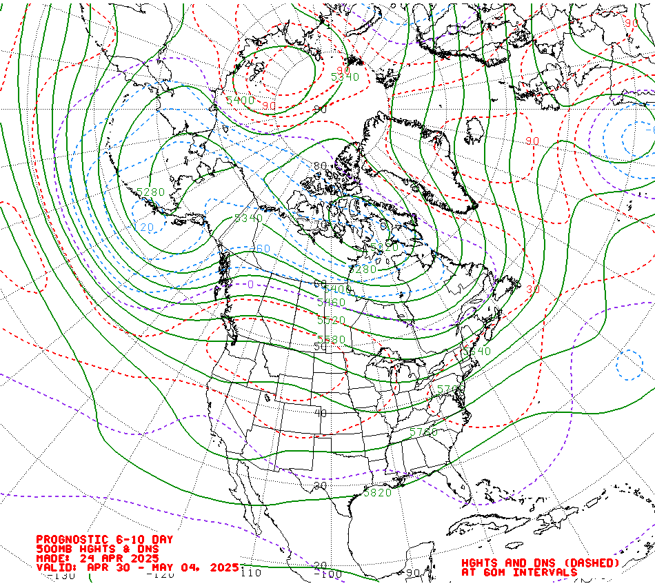
This map shows anomalously high heights in the northeastern United States stretching back across the northern tier states with low heights south of Alaska and the Aleutian Islands. In general, patterns like this represent fast moving west to east storm tracks and temperatures near to slightly above normal. The 6-10 day temperature outlook closely matches the height anomalies above:

Temperatures will remain cool over northeastern Colorado through the weekend, but as the west coast ridge approaches the area on Monday, temperatures should moderate with highs reaching into the low 40s F. Conditions should be predominantly dry especially in Nederland and other locations on the east side of the Divide.
The weather pattern may get a little more interesting by the middle of next week when at least the GFS is hinting at a split flow regime setting up over the western United States. In these patterns, pieces of energy in the upper levels of the atmosphere can interact with each (or phase) to produce storms. Here is the 500 mb map for the middle of next week. The red X’s represent pieces of energy (vortexes) in the northern and southern branches of upper level wind flow (the red arrows):
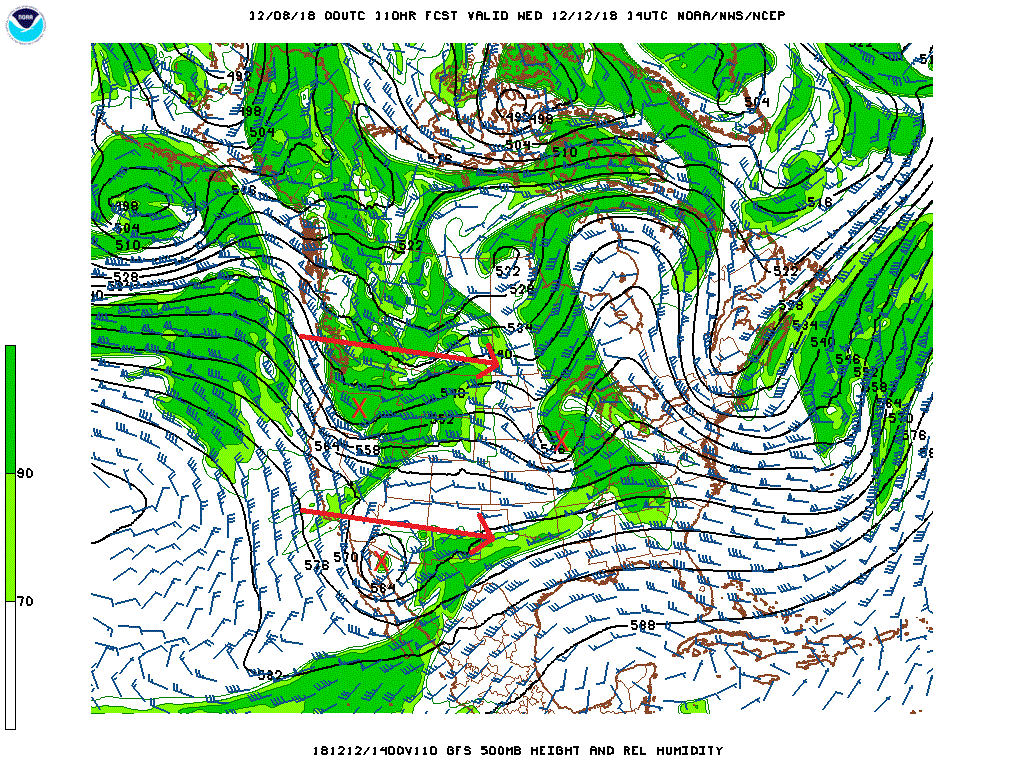
While Colorado can often end up sandwiched in between these branches of flow and energy with calm weather, sometimes enough phasing can occur to result in a decent precipitation event. It is something to keep an eye on the next several days.
Enjoy the cool but dry weekend. The Nordic skiing is very good right now in the Indian Peaks!